Kabanjahe night lights from space
Night Light of Kabanjahe (North Sumatra) from space (Indonesia) Src. Average luminocity for 10x10km area is 3.6082% and for 50x50km: 0.6492%.
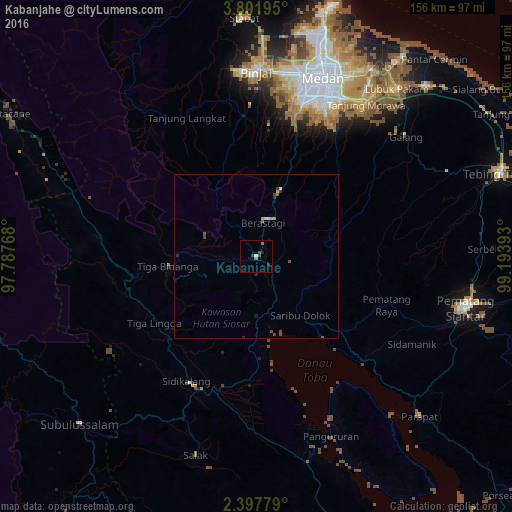
Analysis of Kabanjahe night lights 2016
Square area 10x10 km:
 0%
0%90-99
0.87%80-89
0%70-79
0%60-69
0.87%50-59
0.87%40-49
0%30-39
2.6%20-29
1.52%10-19
0.87%0-9
92.42%Square area 50x50 km:
0.06%90-99
0.08%80-89
0.03%70-79
0.11%60-69
0.07%50-59
0.12%40-49
0.24%30-39
0.19%20-29
0.13%10-19
0.07%0-9
98.9%Clear (daylight) street map image can be seen on geolist.org.
Map coordinates:
3° 48' 7" North, 97° 47' 15.6" East
3° 6' 0.4" North, 98° 29' 26.9" East
2° 23' 52" North, 99° 11' 38.1" East
Some cities around Kabanjahe sort by population:
• Medan
57.2 km =35.5 mi,  19°
19°
• Binjai
55.6 km =34.5 mi,  359°
359°
• Pematangsiantar
66 km =41 mi,  103°
103°
• Sunggal
54.7 km =34 mi,  14°
14°
• Berastagi
10.7 km =6.6 mi, 10°
• Deli Tua
50.1 km =31.1 mi,  25°
25°
• Tongging
22.7 km =14.1 mi,  170°
170°
• Tomok Bolon
64.6 km =40.1 mi,  140°
140°
1214965 (p: 57,159)
Sources (retrieved 2019-11-25):
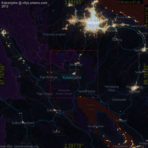
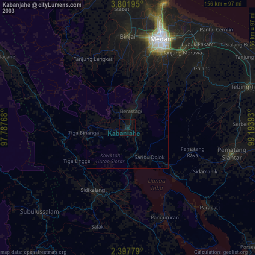
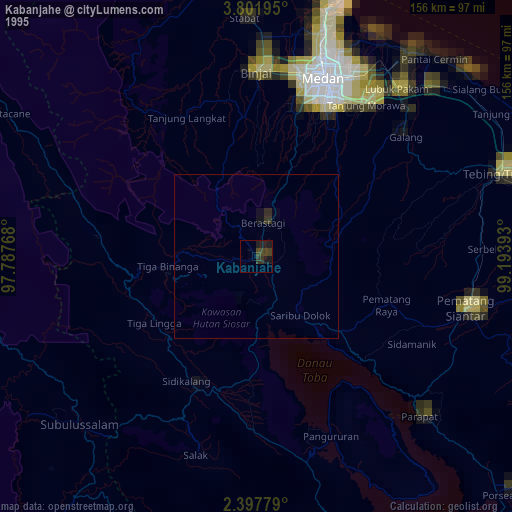
» NASA, Earths city lights 1995
» NASA city lights 2003
» Earth at Night: Flat Maps 2012, 2016