Berastagi night lights from space
Night Light of Berastagi (North Sumatra) from space (Indonesia) Src. Average luminocity for 10x10km area is 5.0519% and for 50x50km: 0.5719%.
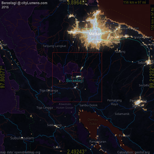
Analysis of Berastagi night lights 2016
Square area 10x10 km:
 1.3%
1.3%90-99
0.43%80-89
0.65%70-79
1.95%60-69
0.87%50-59
0%40-49
0%30-39
0%20-29
0%10-19
0%0-9
94.81%Square area 50x50 km:
0.06%90-99
0.08%80-89
0.03%70-79
0.11%60-69
0.07%50-59
0.1%40-49
0.1%30-39
0.19%20-29
0.08%10-19
0.03%0-9
99.14%Clear (daylight) street map image can be seen on geolist.org.
Map coordinates:
3° 53' 47.2" North, 97° 48' 20.8" East
3° 11' 40.8" North, 98° 30' 32" East
2° 29' 32.7" North, 99° 12' 43.3" East
Some cities around Berastagi sort by population:
• Medan
46.6 km =29 mi,  22°
22°
• Binjai
45.2 km =28.1 mi,  356°
356°
• Sunggal
44.1 km =27.4 mi, 15°
• Kabanjahe
10.7 km =6.6 mi,  190°
190°
• Labuhan Deli
62 km =38.5 mi, 17°
• Deli Tua
39.9 km =24.8 mi,  29°
29°
• Stabat
60.2 km =37.4 mi,  353°
353°
• Tongging
33 km =20.5 mi,  177°
177°
1215395 (p: 44,765)
Sources (retrieved 2019-11-25):
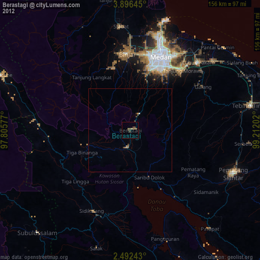
» Earth at Night: Flat Maps 2012, 2016