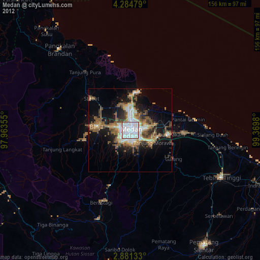
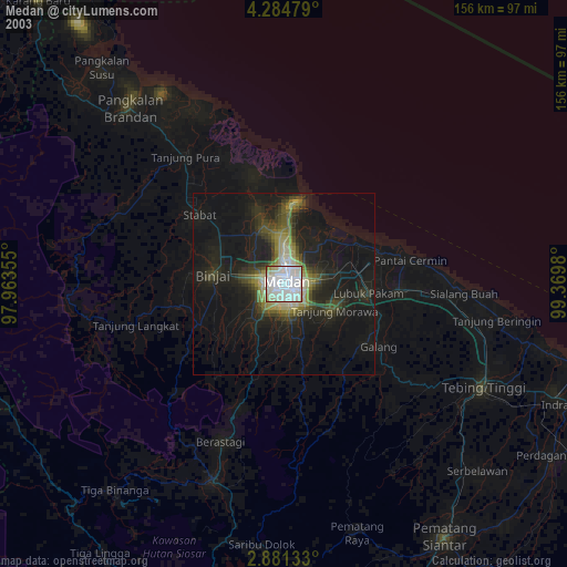
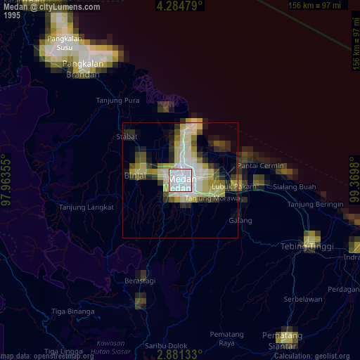
Medan night lights from space
Night Light of Medan (North Sumatra) from space (Indonesia) Src. Average luminocity for 10x10km area is 99.7814% and for 50x50km: 37.503%.
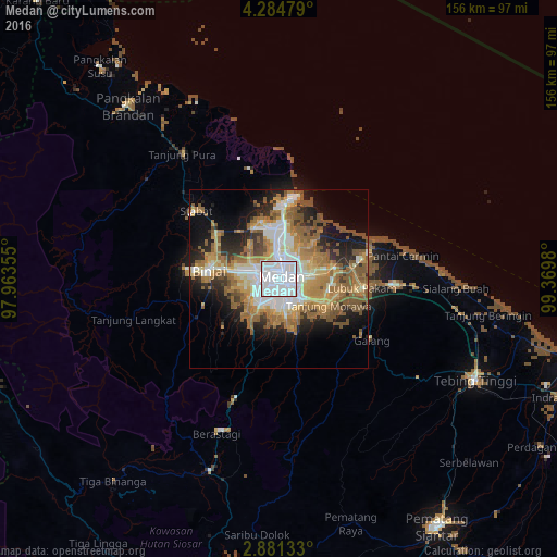
Analysis of Medan night lights 2016
Square area 10x10 km:
 83.33%
90-99
16.67%80-89
0%70-79
0%60-69
0%50-59
0%40-49
0%30-39
0%20-29
0%10-19
0%0-9
0%Square area 50x50 km:
7.4%90-99
6.1%80-89
3.98%70-79
6.04%60-69
8.38%50-59
8.48%40-49
3.74%30-39
2.56%20-29
6.3%10-19
10.44%0-9
36.59%Clear (daylight) street map image can be seen on geolist.org.
Map coordinates:
4° 17' 5.2" North, 97° 57' 48.8" East
3° 34' 60" North, 98° 40' 0" East
2° 52' 52.8" North, 99° 22' 11.3" East
Some cities around Medan sort by population:
• Percut
22.4 km =13.9 mi,  77°
77°
• Binjai
20.2 km =12.6 mi,  275°
275°
• Sunggal
5.8 km =3.6 mi,  262°
262°
• Perbaungan
32.2 km =20 mi,  93°
93°
• Belawan
21.4 km =13.3 mi,  4°
4°
• Labuhan Deli
16.1 km =10 mi, 2°
• Deli Tua
8.6 km =5.3 mi,  167°
167°
• Stabat
29.2 km =18.1 mi,  304°
304°
1214520 (p: 1,750,971)
Sources (retrieved 2019-11-25):
» NASA, Earths city lights 1995
» NASA city lights 2003
» Earth at Night: Flat Maps 2012, 2016