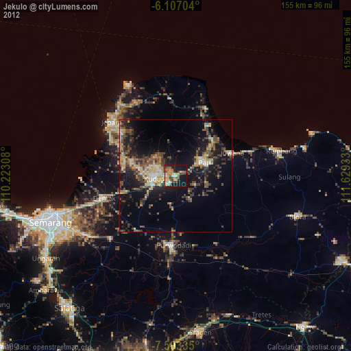
Jekulo night lights from space
Night Light of Jekulo (Central Java) from space (Indonesia) Src. Average luminocity for 10x10km area is 47.4069% and for 50x50km: 21.3848%.
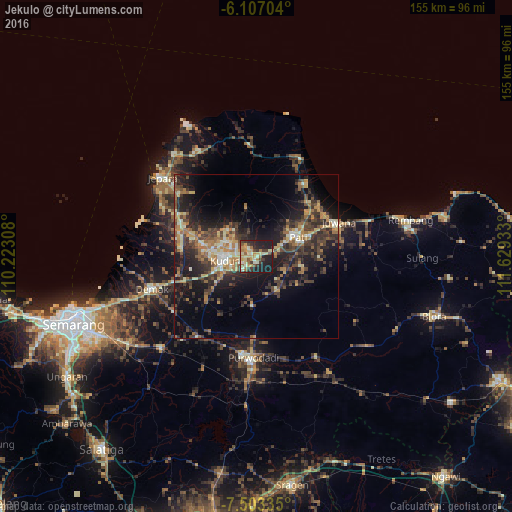
Analysis of Jekulo night lights 2016
Square area 10x10 km:
 0%
0%90-99
10.61%80-89
10.82%70-79
10.39%60-69
6.49%50-59
5.41%40-49
5.84%30-39
9.96%20-29
15.8%10-19
24.68%0-9
0%Square area 50x50 km:
0.37%90-99
3.23%80-89
2.71%70-79
3.25%60-69
3.71%50-59
2.84%40-49
4.77%30-39
5.65%20-29
8.47%10-19
15.24%0-9
49.77%Clear (daylight) street map image can be seen on geolist.org.
Map coordinates:
6° 6' 25.3" South, 110° 13' 23.1" East
6° 48' 20.5" South, 110° 55' 34.3" East
7° 30' 12.1" South, 111° 37' 45.6" East
Some cities around Jekulo sort by population:
• Purwodadi
31.3 km =19.4 mi,  182°
182°
• Pati
13.5 km =8.4 mi,  65°
65°
• Kudus
9.5 km =5.9 mi,  270°
270°
• Pecangaan
26.6 km =16.5 mi,  296°
296°
• Baekrajan
9 km =5.6 mi, 298°
• Gebog
12 km =7.5 mi,  311°
311°
• Juwana
26.8 km =16.7 mi, 67°
• Welahan
23.1 km =14.4 mi, 271°
1642628 (p: 37,521)
Sources (retrieved 2019-11-25):
» Earth at Night: Flat Maps 2012, 2016