Labuhan Deli night lights from space
Night Light of Labuhan Deli (North Sumatra) from space (Indonesia) Src. Average luminocity for 10x10km area is 72.7987% and for 50x50km: 33.9418%.
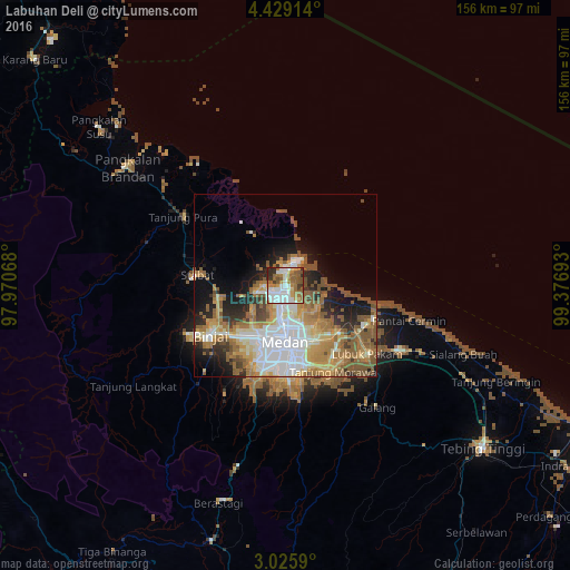
Analysis of Labuhan Deli night lights 2016
Square area 10x10 km:
 17.75%
90-99
21%80-89
4.11%70-79
7.58%60-69
19.26%50-59
14.5%40-49
3.03%30-39
6.71%20-29
6.06%10-19
0%0-9
0%Square area 50x50 km:
7.41%90-99
5.99%80-89
3.74%70-79
5.23%60-69
6.91%50-59
7.37%40-49
3.44%30-39
2.2%20-29
5.02%10-19
7.74%0-9
44.95%Clear (daylight) street map image can be seen on geolist.org.
Map coordinates:
4° 25' 44.9" North, 97° 58' 14.4" East
3° 43' 40.1" North, 98° 40' 25.7" East
3° 1' 33.2" North, 99° 22' 36.9" East
Some cities around Labuhan Deli sort by population:
• Medan
16.1 km =10 mi,  182°
182°
• Percut
24 km =14.9 mi,  118°
118°
• Binjai
25.3 km =15.7 mi,  235°
235°
• Sunggal
18 km =11.2 mi,  201°
201°
• Perbaungan
36 km =22.4 mi, 119°
• Belawan
5.4 km =3.4 mi,  11°
11°
• Deli Tua
24.5 km =15.2 mi, 177°
• Stabat
24.8 km =15.4 mi,  271°
271°
1214800 (p: 49,668)
Sources (retrieved 2019-11-25):
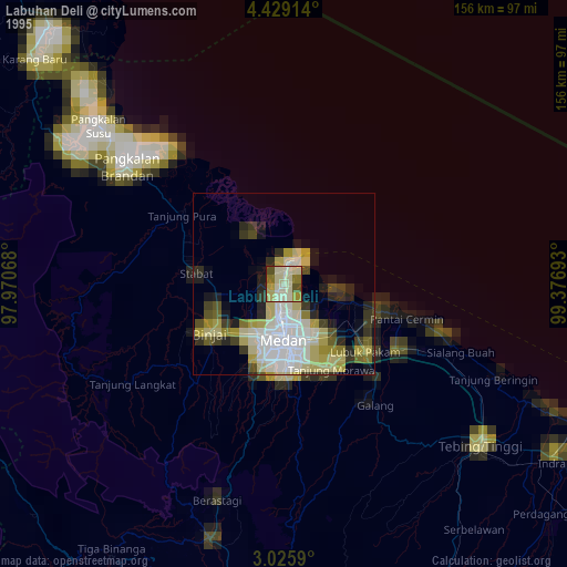
» NASA, Earths city lights 1995
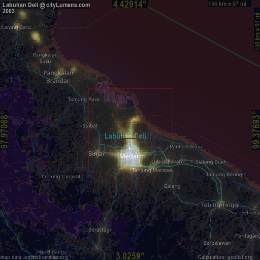
» NASA city lights 2003
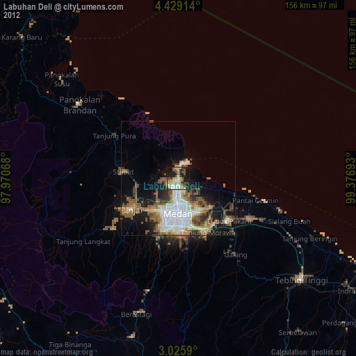
» Earth at Night: Flat Maps 2012, 2016