Tura night lights from space
Night Light of Tura (Pest) from space (Hungary) Src. Average luminocity for 10x10km area is 1.1193% and for 50x50km: 5.7399%.
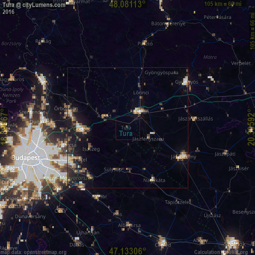
Analysis of Tura night lights 2016
Square area 10x10 km:
100  0%
0%
90-99 0%
80-89 0%
70-79 0%
60-69 0%
50-59 0%
40-49 0.57%
30-39 0.28%
20-29 0%
10-19 0%
0-9 99.15%
0%90-99
0%80-89
0%70-79
0%60-69
0%50-59
0%40-49
0.57%30-39
0.28%20-29
0%10-19
0%0-9
99.15%Square area 50x50 km:
100 0.45%
90-99 0.67%
80-89 0.49%
70-79 0.71%
60-69 0.74%
50-59 0.98%
40-49 1.11%
30-39 1.23%
20-29 1.66%
10-19 4.81%
0-9 87.16%
0.45%90-99
0.67%80-89
0.49%70-79
0.71%60-69
0.74%50-59
0.98%40-49
1.11%30-39
1.23%20-29
1.66%10-19
4.81%0-9
87.16%Clear (daylight) street map image can be seen on geolist.org.
Map coordinates:
48° 4' 52.1" North, 18° 53' 58.8" East
47° 36' 33.3" North, 19° 36' 10" East
47° 7' 59" North, 20° 18' 21.3" East
Some cities around Tura sort by population:
• Gödöllő
18.6 km =11.6 mi,  265°
265°
• Hatvan
8.8 km =5.5 mi,  43°
43°
• Isaszeg
17.4 km =10.8 mi,  239°
239°
• Sülysáp
18.2 km =11.3 mi,  196°
196°
• Tápiószecső
17.7 km =11 mi,  178°
178°
• Aszód
10.4 km =6.5 mi,  296°
296°
• Lőrinci
14.9 km =9.3 mi,  22°
22°
• Kartal
8.3 km =5.2 mi,  326°
326°
3043678 (p: 8,294)
Sources (retrieved 2019-11-25):
» Earth at Night: Flat Maps 2012, 2016