Lőrinci night lights from space
Night Light of Lőrinci (Heves) from space (Hungary) Src. Average luminocity for 10x10km area is 2.8527% and for 50x50km: 2.5251%.
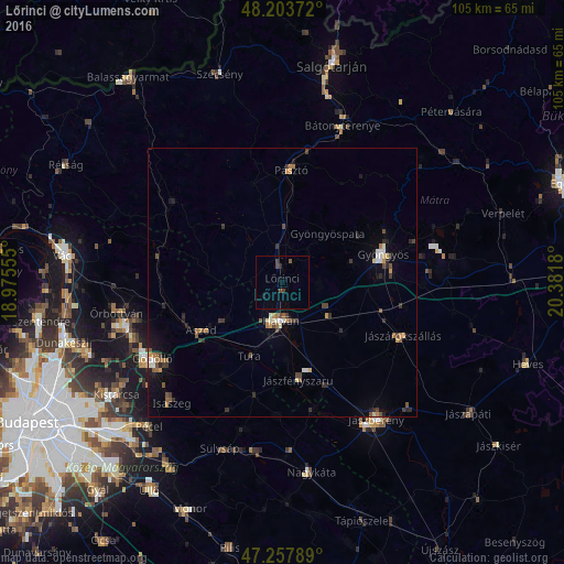
Analysis of Lőrinci night lights 2016
Square area 10x10 km:
 0%
0%90-99
0%80-89
0%70-79
0%60-69
0%50-59
0.6%40-49
1.79%30-39
0.6%20-29
0.3%10-19
0.89%0-9
95.83%Square area 50x50 km:
0.2%90-99
0.26%80-89
0.14%70-79
0.36%60-69
0.33%50-59
0.38%40-49
0.53%30-39
0.53%20-29
0.61%10-19
0.91%0-9
95.77%Clear (daylight) street map image can be seen on geolist.org.
Map coordinates:
48° 12' 13.4" North, 18° 58' 32" East
47° 43' 58.6" North, 19° 40' 43.2" East
47° 15' 28.4" North, 20° 22' 54.5" East
Some cities around Lőrinci sort by population:
• Gyöngyös
19.4 km =12.1 mi,  73°
73°
• Hatvan
7.4 km =4.6 mi,  177°
177°
• Pásztó
20.9 km =13 mi,  4°
4°
• Tura
14.9 km =9.3 mi,  202°
202°
• Jászárokszállás
24.7 km =15.3 mi,  114°
114°
• Aszód
17.5 km =10.9 mi,  238°
238°
• Kartal
12.3 km =7.6 mi, 236°
• Erdőkertes
28.5 km =17.7 mi,  256°
256°
3048725 (p: 6,089)
Sources (retrieved 2019-11-25):
» Earth at Night: Flat Maps 2012, 2016