Aszód night lights from space
Night Light of Aszód (Pest) from space (Hungary) Src. Average luminocity for 10x10km area is 3.6935% and for 50x50km: 10.3282%.
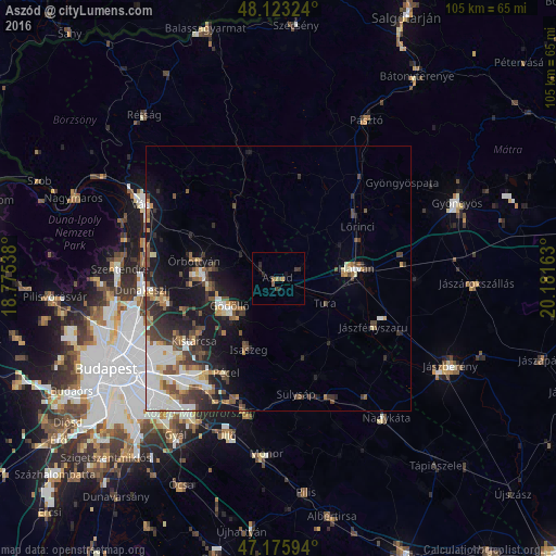
Analysis of Aszód night lights 2016
Square area 10x10 km:
 0%
0%90-99
0%80-89
0%70-79
0.6%60-69
1.19%50-59
0.74%40-49
0.6%30-39
1.49%20-29
2.38%10-19
0.74%0-9
92.26%Square area 50x50 km:
2.18%90-99
1.63%80-89
0.77%70-79
1%60-69
1.09%50-59
1.66%40-49
1.64%30-39
2.1%20-29
2.41%10-19
6.37%0-9
79.15%Clear (daylight) street map image can be seen on geolist.org.
Map coordinates:
48° 7' 23.7" North, 18° 46' 31.4" East
47° 39' 6.3" North, 19° 28' 42.6" East
47° 10' 33.4" North, 20° 10' 53.9" East
Some cities around Aszód sort by population:
• Gödöllő
11.1 km =6.9 mi,  236°
236°
• Hatvan
15.4 km =9.6 mi,  83°
83°
• Veresegyház
13.7 km =8.5 mi,  267°
267°
• Isaszeg
14.7 km =9.1 mi,  202°
202°
• Tura
10.4 km =6.5 mi,  116°
116°
• Kartal
5.2 km =3.2 mi,  65°
65°
• Erdőkertes
13 km =8.1 mi,  280°
280°
• Őrbottyán
15.2 km =9.4 mi, 284°
3054693 (p: 6,186)
Sources (retrieved 2019-11-25):
» Earth at Night: Flat Maps 2012, 2016