Tápiószele night lights from space
Night Light of Tápiószele (Pest) from space (Hungary) Src. Average luminocity for 10x10km area is 0.4464% and for 50x50km: 3.0562%.
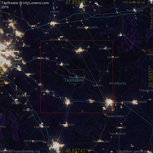
Analysis of Tápiószele night lights 2016
Square area 10x10 km:
 0%
0%90-99
0%80-89
0%70-79
0%60-69
0%50-59
0%40-49
0%30-39
0.6%20-29
0.6%10-19
0%0-9
98.81%Square area 50x50 km:
0.3%90-99
0.41%80-89
0.26%70-79
0.3%60-69
0.38%50-59
0.59%40-49
0.67%30-39
0.56%20-29
0.64%10-19
1.66%0-9
94.23%Clear (daylight) street map image can be seen on geolist.org.
Map coordinates:
47° 48' 37.6" North, 19° 10' 26.8" East
47° 20' 9.9" North, 19° 52' 38.1" East
46° 51' 26.7" North, 20° 34' 49.3" East
Some cities around Tápiószele sort by population:
• Cegléd
19.1 km =11.9 mi,  197°
197°
• Jászberény
18.5 km =11.5 mi,  9°
9°
• Abony
18.9 km =11.7 mi,  149°
149°
• Nagykáta
13.3 km =8.3 mi,  311°
311°
• Albertirsa
22.2 km =13.8 mi,  242°
242°
• Pilis
25.3 km =15.7 mi,  258°
258°
• Újszász
16 km =9.9 mi,  104°
104°
• Jászladány
22.1 km =13.7 mi,  81°
81°
3044151 (p: 6,214)
Sources (retrieved 2019-11-25):
» Earth at Night: Flat Maps 2012, 2016