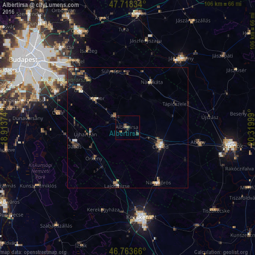
Albertirsa night lights from space
Night Light of Albertirsa (Pest) from space (Hungary) Src. Average luminocity for 10x10km area is 4.3348% and for 50x50km: 3.3036%.
Analysis of Albertirsa night lights 2016
Square area 10x10 km:
 0%
0%90-99
0%80-89
0%70-79
0.74%60-69
0.89%50-59
1.49%40-49
1.79%30-39
2.68%20-29
0.3%10-19
0.45%0-9
91.67%Square area 50x50 km:
0.14%90-99
0.32%80-89
0.32%70-79
0.34%60-69
0.49%50-59
0.79%40-49
0.65%30-39
0.74%20-29
1%10-19
1.85%0-9
93.37%Clear (daylight) street map image can be seen on geolist.org.
Map coordinates:
47° 43' 6" North, 18° 54' 49.5" East
47° 14' 35.3" North, 19° 37' 0.7" East
46° 45' 49.2" North, 20° 19' 12" East
Some cities around Albertirsa sort by population:
• Cegléd
15.9 km =9.9 mi,  119°
119°
• Monor
17.6 km =10.9 mi,  313°
313°
• Nagykáta
21.4 km =13.3 mi,  26°
26°
• Pilis
7.3 km =4.5 mi, 314°
• Tápiószecső
23 km =14.3 mi,  358°
358°
• Tápiószele
22.2 km =13.8 mi,  62°
62°
• Tápiószentmárton
14.5 km =9 mi,  42°
42°
• Örkény
18.7 km =11.6 mi,  227°
227°
3056326 (p: 11,864)
Sources (retrieved 2019-11-25):
» Earth at Night: Flat Maps 2012, 2016