Székesfehérvár night lights from space
Night Light of Székesfehérvár (Fejér) from space (Hungary) Src. Average luminocity for 10x10km area is 45.5432% and for 50x50km: 4.439%.
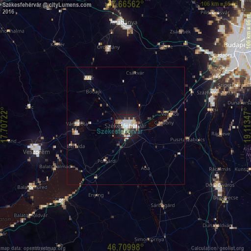
Analysis of Székesfehérvár night lights 2016
Square area 10x10 km:
 10.86%
90-99
11.61%80-89
5.06%70-79
4.02%60-69
5.8%50-59
2.98%40-49
2.08%30-39
3.72%20-29
16.96%10-19
27.38%0-9
9.52%Square area 50x50 km:
0.59%90-99
0.72%80-89
0.45%70-79
0.5%60-69
0.53%50-59
0.44%40-49
0.76%30-39
0.46%20-29
1.16%10-19
2.77%0-9
91.62%Clear (daylight) street map image can be seen on geolist.org.
Map coordinates:
47° 39' 56.2" North, 17° 42' 26" East
47° 11' 23.8" North, 18° 24' 37.2" East
46° 42' 35.9" North, 19° 6' 48.5" East
Some cities around Székesfehérvár sort by population:
• Várpalota
20.5 km =12.7 mi,  272°
272°
• Mór
26.1 km =16.2 mi,  323°
323°
• Gárdony
17.2 km =10.7 mi,  82°
82°
• Enying
31.5 km =19.6 mi,  203°
203°
• Polgárdi
16.5 km =10.3 mi,  209°
209°
• Pusztaszabolcs
27.6 km =17.1 mi,  102°
102°
• Berhida
23 km =14.3 mi,  247°
247°
• Csákvár
22.8 km =14.2 mi,  10°
10°
3044774 (p: 101,600)
Sources (retrieved 2019-11-25):
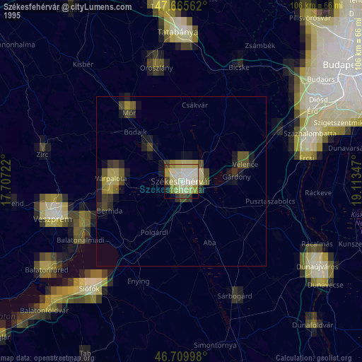
» NASA, Earths city lights 1995
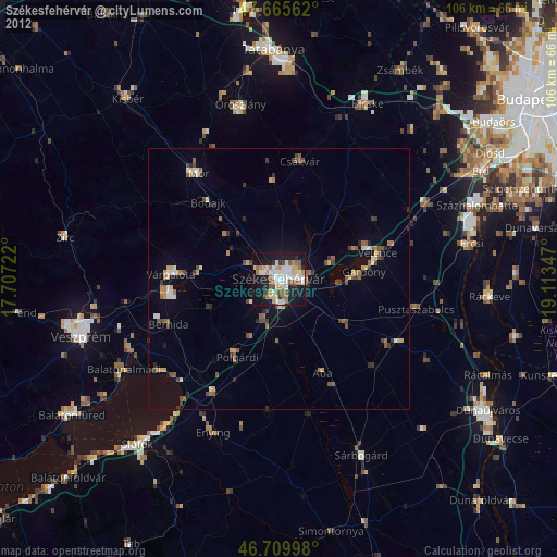
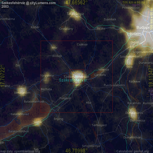
» NASA city lights 2003
» Earth at Night: Flat Maps 2012, 2016