Gyöngyös night lights from space
Night Light of Gyöngyös (Heves) from space (Hungary) Src. Average luminocity for 10x10km area is 12.7813% and for 50x50km: 2.0406%.
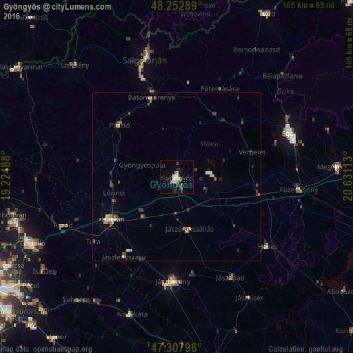
Analysis of Gyöngyös night lights 2016
Square area 10x10 km:
 2.53%
2.53%90-99
2.23%80-89
1.34%70-79
1.64%60-69
0.6%50-59
0.15%40-49
1.64%30-39
0.6%20-29
3.87%10-19
2.83%0-9
82.59%Square area 50x50 km:
0.19%90-99
0.27%80-89
0.16%70-79
0.32%60-69
0.24%50-59
0.16%40-49
0.48%30-39
0.42%20-29
0.52%10-19
0.42%0-9
96.82%Clear (daylight) street map image can be seen on geolist.org.
Map coordinates:
48° 15' 10.4" North, 19° 13' 29.6" East
47° 46' 57.3" North, 19° 55' 40.8" East
47° 18' 28.7" North, 20° 37' 52.1" East
Some cities around Gyöngyös sort by population:
• Parádsasvár
14.9 km =9.3 mi,  14°
14°
• Jászberény
31.4 km =19.5 mi,  181°
181°
• Hatvan
22.4 km =13.9 mi,  234°
234°
• Bátonyterenye
21.8 km =13.5 mi,  342°
342°
• Pásztó
23 km =14.3 mi,  311°
311°
• Tura
31 km =19.3 mi, 231°
• Jászárokszállás
16.1 km =10 mi,  165°
165°
• Lőrinci
19.4 km =12.1 mi,  253°
253°
3052040 (p: 32,938)
Sources (retrieved 2019-11-25):
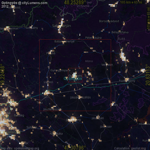
» Earth at Night: Flat Maps 2012, 2016