Hosszúpályi night lights from space
Night Light of Hosszúpályi (Hajdú-Bihar) from space (Hungary) Src. Average luminocity for 10x10km area is 0.6051% and for 50x50km: 3.9713%.
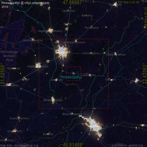
Analysis of Hosszúpályi night lights 2016
Square area 10x10 km:
 0%
0%90-99
0%80-89
0%70-79
0%60-69
0%50-59
0.57%40-49
0%30-39
0%20-29
0%10-19
1.42%0-9
98.01%Square area 50x50 km:
0.64%90-99
0.78%80-89
0.35%70-79
0.39%60-69
0.34%50-59
0.48%40-49
0.54%30-39
0.51%20-29
1.33%10-19
2.71%0-9
91.94%Clear (daylight) street map image can be seen on geolist.org.
Map coordinates:
47° 52' 0.7" North, 21° 1' 46.8" East
47° 23' 34.9" North, 21° 43' 58.1" East
46° 54' 53.6" North, 22° 26' 9.3" East
Some cities around Hosszúpályi sort by population:
• Debrecen
17.3 km =10.7 mi,  334°
334°
• Hajdúszoboszló
25.8 km =16 mi,  284°
284°
• Berettyóújfalu
24 km =14.9 mi,  215°
215°
• Hajdúsámson
23.2 km =14.4 mi,  6°
6°
• Derecske
13.4 km =8.3 mi,  249°
249°
• Létavértes
12.6 km =7.8 mi,  94°
94°
• Diosig, RO
22.6 km =14 mi,  117°
117°
• Vámospércs
20 km =12.4 mi,  38°
38°
719843 (p: 5,479)
Sources (retrieved 2019-11-25):
» Earth at Night: Flat Maps 2012, 2016