Esztergom night lights from space
Night Light of Esztergom (Komárom-Esztergom) from space (Hungary) Src. Average luminocity for 10x10km area is 21.8214% and for 50x50km: 5.2437%.
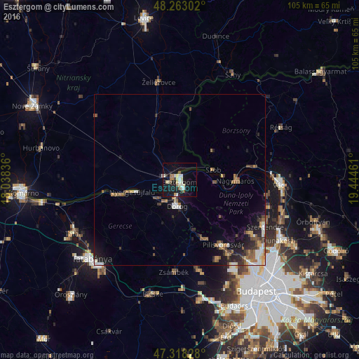
Analysis of Esztergom night lights 2016
Square area 10x10 km:
 2.83%
2.83%90-99
5.21%80-89
3.57%70-79
0.74%60-69
2.23%50-59
2.38%40-49
1.04%30-39
1.34%20-29
1.79%10-19
31.25%0-9
47.62%Square area 50x50 km:
0.59%90-99
0.87%80-89
0.42%70-79
0.45%60-69
0.85%50-59
1.07%40-49
0.63%30-39
0.82%20-29
1.2%10-19
3.88%0-9
89.22%Clear (daylight) street map image can be seen on geolist.org.
Map coordinates:
48° 15' 46.9" North, 18° 2' 18.1" East
47° 47' 34.1" North, 18° 44' 29.3" East
47° 19' 5.8" North, 19° 26' 40.6" East
Some cities around Esztergom sort by population:
• Pilisvörösvár
23.5 km =14.6 mi,  147°
147°
• Dorog
8 km =5 mi,  182°
182°
• Štúrovo, SK
1.8 km =1.1 mi,  277°
277°
• Solymár
26.5 km =16.5 mi, 147°
• Nyergesújfalu
14.3 km =8.9 mi,  255°
255°
• Piliscsaba
18.8 km =11.7 mi,  159°
159°
• Tát
9 km =5.6 mi,  230°
230°
• Lábatlan
19 km =11.8 mi,  254°
254°
3053163 (p: 28,785)
Sources (retrieved 2019-11-25):
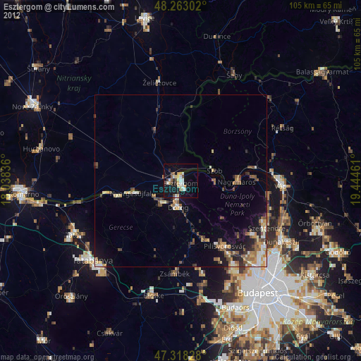
» Earth at Night: Flat Maps 2012, 2016