Eger night lights from space
Night Light of Eger (Heves) from space (Hungary) Src. Average luminocity for 10x10km area is 20.7344% and for 50x50km: 1.9407%.
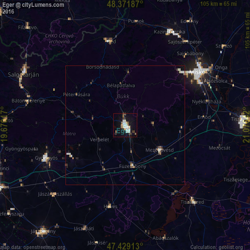
Analysis of Eger night lights 2016
Square area 10x10 km:
 4.83%
4.83%90-99
3.98%80-89
1.99%70-79
0.57%60-69
2.41%50-59
1.56%40-49
2.56%30-39
2.27%20-29
1.28%10-19
21.45%0-9
57.1%Square area 50x50 km:
0.27%90-99
0.4%80-89
0.13%70-79
0.09%60-69
0.17%50-59
0.27%40-49
0.28%30-39
0.37%20-29
0.39%10-19
1.34%0-9
96.29%Clear (daylight) street map image can be seen on geolist.org.
Map coordinates:
48° 22' 18.7" North, 19° 40' 12.6" East
47° 54' 9.5" North, 20° 22' 23.8" East
47° 25' 44.9" North, 21° 4' 35.1" East
Some cities around Eger sort by population:
• Miskolc
37.6 km =23.4 mi,  54°
54°
• Parádsasvár
29.6 km =18.4 mi,  272°
272°
• Ózd
35.3 km =21.9 mi,  351°
351°
• Gyöngyös
35.8 km =22.2 mi,  248°
248°
• Mezőkövesd
18.4 km =11.4 mi,  121°
121°
• Heves
34.3 km =21.3 mi,  191°
191°
• Füzesabony
17.3 km =10.7 mi,  169°
169°
• Emőd
33.2 km =20.6 mi,  84°
84°
721239 (p: 56,647)
Sources (retrieved 2019-11-25):
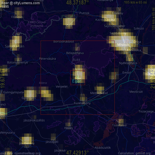
» NASA, Earths city lights 1995
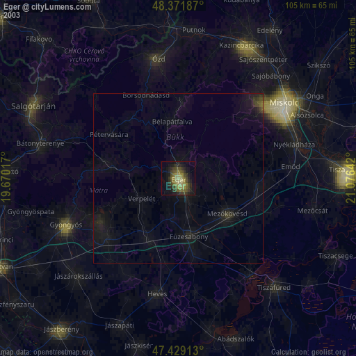
» NASA city lights 2003
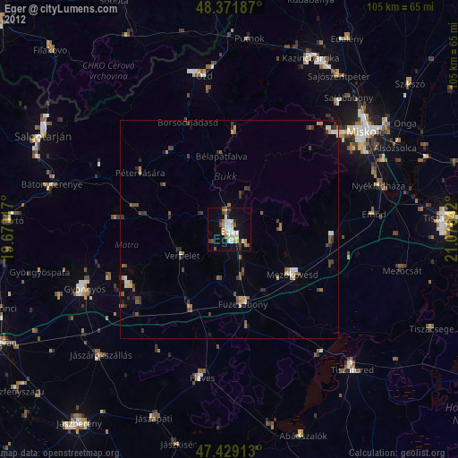
» Earth at Night: Flat Maps 2012, 2016