Budapest XVII. kerület night lights from space
Night Light of Budapest XVII. kerület (Budapest) from space (Hungary) Src. Average luminocity for 10x10km area is 64.8494% and for 50x50km: 30.5248%.
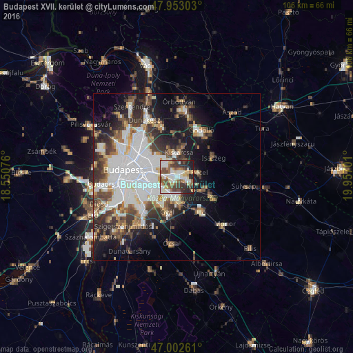
Analysis of Budapest XVII. kerület night lights 2016
Square area 10x10 km:
 14.77%
90-99
18.32%80-89
6.25%70-79
7.24%60-69
6.53%50-59
10.37%40-49
10.51%30-39
11.36%20-29
11.65%10-19
2.98%0-9
0%Square area 50x50 km:
10.06%90-99
5.67%80-89
2.18%70-79
2.33%60-69
3.06%50-59
3.74%40-49
4.12%30-39
4.98%20-29
6.02%10-19
11.28%0-9
46.56%Clear (daylight) street map image can be seen on geolist.org.
Map coordinates:
47° 57' 10.9" North, 18° 33' 2.7" East
47° 28' 47.9" North, 19° 15' 14" East
47° 0' 9.4" North, 19° 57' 25.2" East
Some cities around Budapest XVII. kerület sort by population:
• Kőbánya
8.6 km =5.3 mi,  273°
273°
• Kispest
9.1 km =5.7 mi,  249°
249°
• Vecsés
8.5 km =5.3 mi,  163°
163°
• Pécel
6.7 km =4.2 mi,  80°
80°
• Kistarcsa
7.5 km =4.7 mi,  4°
4°
• Maglód
9.3 km =5.8 mi,  116°
116°
• Kerepes
9.2 km =5.7 mi,  13°
13°
• Csömör
7.9 km =4.9 mi,  348°
348°
7284841 (p: 78,250)
Sources (retrieved 2019-11-25):
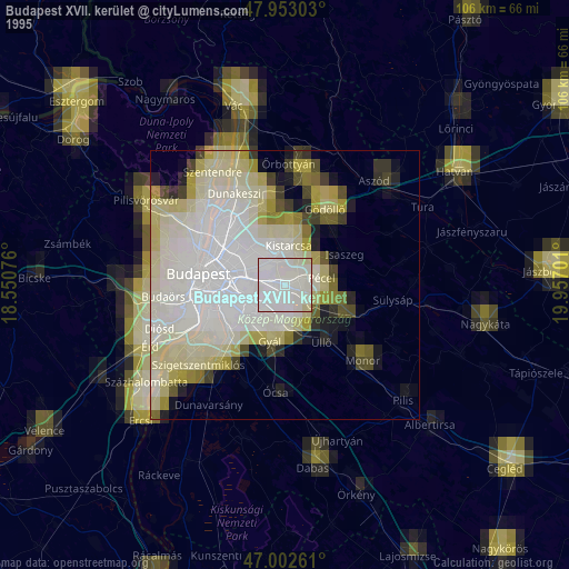
» NASA, Earths city lights 1995
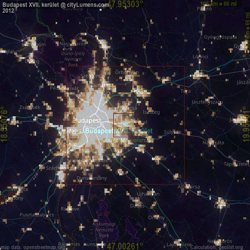
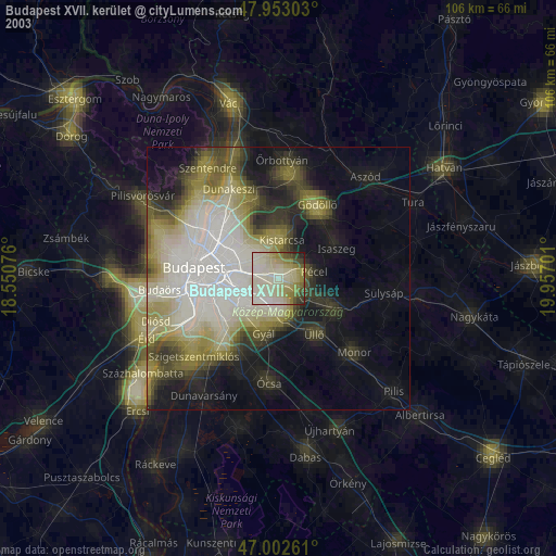
» NASA city lights 2003
» Earth at Night: Flat Maps 2012, 2016