Cornillon night lights from space
Night Light of Cornillon (Ouest) from space (Haiti) Src. Average luminocity for 10x10km area is 0% and for 50x50km: 0.5152%.
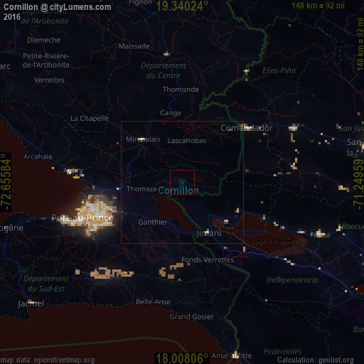
Analysis of Cornillon night lights 2016
Square area 10x10 km:
 0%
0%90-99
0%80-89
0%70-79
0%60-69
0%50-59
0%40-49
0%30-39
0%20-29
0%10-19
0%0-9
100%Square area 50x50 km:
0%90-99
0.03%80-89
0.13%70-79
0.06%60-69
0.06%50-59
0.06%40-49
0.02%30-39
0.2%20-29
0.19%10-19
0.15%0-9
99.11%Clear (daylight) street map image can be seen on geolist.org.
Map coordinates:
19° 20' 24.9" North, 72° 39' 21" West
18° 40' 31.7" North, 71° 57' 9.8" West
18° 0' 29" North, 71° 14' 58.5" West
Some cities around Cornillon sort by population:
• Croix-des-Bouquets
30.8 km =19.1 mi,  249°
249°
• Thomazeau
15.1 km =9.4 mi,  260°
260°
• Fond Parisien
19.1 km =11.9 mi,  189°
189°
• Comendador, DO
34.6 km =21.5 mi,  49°
49°
• Mirebalais
23.9 km =14.9 mi,  317°
317°
• Lascahobas
17.3 km =10.7 mi,  5°
5°
• Jimaní, DO
23.1 km =14.4 mi,  152°
152°
• La Descubierta, DO
26.2 km =16.3 mi,  116°
116°
3727327 (p: 7,572)
Sources (retrieved 2019-11-25):
» Earth at Night: Flat Maps 2012, 2016