Đakovo night lights from space
Night Light of Đakovo (Osječko-Baranjska) from space (Croatia) Src. Average luminocity for 10x10km area is 18.9921% and for 50x50km: 4.4988%.
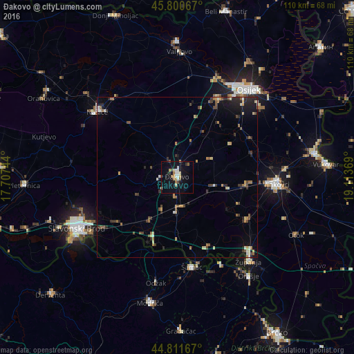
Analysis of Đakovo night lights 2016
Square area 10x10 km:
 3.02%
3.02%90-99
2.54%80-89
2.7%70-79
1.75%60-69
2.22%50-59
2.38%40-49
1.27%30-39
1.27%20-29
1.11%10-19
20.16%0-9
61.59%Square area 50x50 km:
0.23%90-99
0.52%80-89
0.53%70-79
0.59%60-69
0.67%50-59
0.61%40-49
0.71%30-39
0.67%20-29
1.19%10-19
2.62%0-9
91.65%Clear (daylight) street map image can be seen on geolist.org.
Map coordinates:
45° 48' 2.4" North, 17° 42' 26.8" East
45° 18' 30" North, 18° 24' 38" East
44° 48' 42" North, 19° 6' 49.3" East
Some cities around Đakovo sort by population:
• Vinkovci
30.9 km =19.2 mi,  94°
94°
• Županja
34.1 km =21.2 mi,  138°
138°
• Odžak, BA
32.3 km =20.1 mi,  192°
192°
• Čepin
26.7 km =16.6 mi,  26°
26°
• Našice
32.2 km =20 mi,  308°
308°
• Tenja
33.7 km =20.9 mi,  51°
51°
• Ivankovo
21.5 km =13.4 mi,  95°
95°
• Višnjevac
33 km =20.5 mi, 28°
3202220 (p: 19,491)
Sources (retrieved 2019-11-25):
» Earth at Night: Flat Maps 2012, 2016