Merizo Village night lights from space
Night Light of Merizo Village (Merizo) from space (Guam) Src. Average luminocity for 10x10km area is 4.0021% and for 50x50km: 5.8867%.
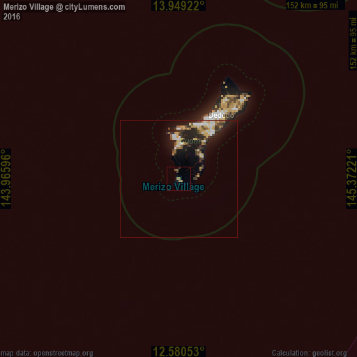
Analysis of Merizo Village night lights 2016
Square area 10x10 km:
 0%
0%90-99
0%80-89
0%70-79
0%60-69
1.03%50-59
3.1%40-49
0.83%30-39
1.24%20-29
0.41%10-19
0%0-9
93.39%Square area 50x50 km:
0.76%90-99
0.71%80-89
0.84%70-79
0.81%60-69
0.68%50-59
0.67%40-49
0.62%30-39
1.38%20-29
2.07%10-19
4.7%0-9
86.76%Clear (daylight) street map image can be seen on geolist.org.
Map coordinates:
13° 56' 57.2" North, 143° 57' 57.5" East
13° 15' 57" North, 144° 40' 8.7" East
12° 34' 49.9" North, 145° 22' 20" East
Some cities around Merizo Village sort by population:
• Santa Rita Village
13.4 km =8.3 mi,  1°
1°
• Chalan Pago-Ordot Village
22.4 km =13.9 mi,  25°
25°
• Yona Village
19.8 km =12.3 mi,  36°
36°
• Agat Village
13.7 km =8.5 mi,  355°
355°
• Talofofo Village
13.9 km =8.6 mi, 44°
• Inarajan Village
8.6 km =5.3 mi,  84°
84°
• Piti Village
22 km =13.7 mi,  6°
6°
• Umatac Village
3.7 km =2.3 mi,  349°
349°
4043399 (p: 2,152)
Sources (retrieved 2019-11-25):
» Earth at Night: Flat Maps 2012, 2016