Santa Rita Village night lights from space
Night Light of Santa Rita Village (Santa Rita) from space (Guam) Src. Average luminocity for 10x10km area is 30.9339% and for 50x50km: 9.4372%.
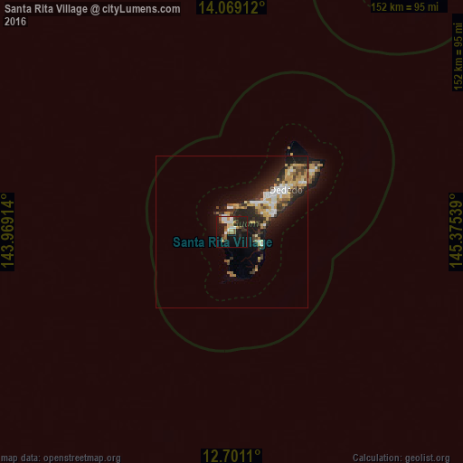
Analysis of Santa Rita Village night lights 2016
Square area 10x10 km:
 4.55%
4.55%90-99
4.75%80-89
4.34%70-79
2.07%60-69
4.96%50-59
4.34%40-49
2.27%30-39
5.79%20-29
7.23%10-19
33.26%0-9
26.45%Square area 50x50 km:
1.29%90-99
1.24%80-89
1.43%70-79
1.45%60-69
1.07%50-59
0.95%40-49
1.1%30-39
1.76%20-29
3.47%10-19
6.94%0-9
79.3%Clear (daylight) street map image can be seen on geolist.org.
Map coordinates:
14° 4' 8.8" North, 143° 58' 8.9" East
13° 23' 9.9" North, 144° 40' 20.1" East
12° 42' 4" North, 145° 22' 31.4" East
Some cities around Santa Rita Village sort by population:
• Chalan Pago-Ordot Village
11.6 km =7.2 mi,  53°
53°
• Yona Village
11.6 km =7.2 mi,  76°
76°
• Agat Village
1.5 km =0.9 mi,  280°
280°
• Agana Heights Village
12 km =7.5 mi,  42°
42°
• Talofofo Village
9.9 km =6.2 mi,  110°
110°
• Asan-Maina Village
10.7 km =6.6 mi,  26°
26°
• Piti Village
8.8 km =5.5 mi,  14°
14°
• Umatac Village
9.8 km =6.1 mi,  185°
185°
4038554 (p: 7,500)
Sources (retrieved 2019-11-25):
» Earth at Night: Flat Maps 2012, 2016