San Mateo Ixtatán night lights from space
Night Light of San Mateo Ixtatán (Huehuetenango) from space (Guatemala) Src. Average luminocity for 10x10km area is 0.526% and for 50x50km: 0.5512%.
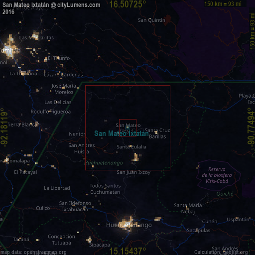
Analysis of San Mateo Ixtatán night lights 2016
Square area 10x10 km:
 0%
0%90-99
0%80-89
0%70-79
0%60-69
0%50-59
0.87%40-49
0%30-39
0%20-29
0%10-19
0%0-9
99.13%Square area 50x50 km:
0%90-99
0.03%80-89
0.06%70-79
0.16%60-69
0.11%50-59
0.12%40-49
0.02%30-39
0.13%20-29
0.21%10-19
0.16%0-9
99%Clear (daylight) street map image can be seen on geolist.org.
Map coordinates:
16° 30' 26.1" North, 92° 10' 52.3" West
15° 49' 55" North, 91° 28' 41" West
15° 9' 15.7" North, 90° 46' 29.8" West
Some cities around San Mateo Ixtatán sort by population:
• Jacaltenango
31 km =19.3 mi,  233°
233°
• Barillas
17.6 km =10.9 mi,  100°
100°
• Soloma
20 km =12.4 mi,  165°
165°
• Concepción Huista
30.6 km =19 mi,  220°
220°
• Chiantla
53.1 km =33 mi,  177°
177°
• San Luis Ixcán
41.3 km =25.7 mi, 96°
• La Libertad
54.8 km =34.1 mi, 229°
• San Antonio Huista
37.4 km =23.2 mi,  237°
237°
3589770 (p: 13,213)
Sources (retrieved 2019-11-25):
» Earth at Night: Flat Maps 2012, 2016