Výronas night lights from space
Night Light of Výronas (Attica) from space (Greece) Src. Average luminocity for 10x10km area is 91.3198% and for 50x50km: 49.6174%.
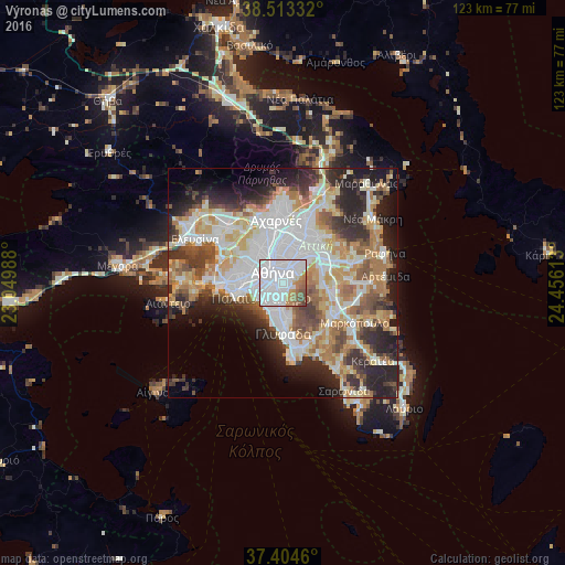
Analysis of Výronas night lights 2016
Square area 10x10 km:
 59.25%
90-99
18.67%80-89
1.3%70-79
5.84%60-69
5.52%50-59
5.84%40-49
3.57%30-39
0%20-29
0%10-19
0%0-9
0%Square area 50x50 km:
13.45%90-99
11.12%80-89
5.37%70-79
6.74%60-69
7.4%50-59
4.76%40-49
5.2%30-39
5.69%20-29
10.55%10-19
9.29%0-9
20.42%Clear (daylight) street map image can be seen on geolist.org.
Map coordinates:
38° 30' 48" North, 23° 2' 59.6" East
37° 57' 39.8" North, 23° 45' 10.8" East
37° 24' 16.6" North, 24° 27' 22.1" East
Some cities around Výronas sort by population:
• Athens
3.4 km =2.1 mi,  318°
318°
• Ilioúpoli
3.5 km =2.2 mi,  158°
158°
• Néa Smýrni
3.8 km =2.4 mi,  242°
242°
• Agios Dimitrios
3.5 km =2.2 mi,  209°
209°
• Zográfos
2.2 km =1.4 mi,  40°
40°
• Kaisarianí
1.1 km =0.7 mi,  76°
76°
• Dhafní
2 km =1.2 mi,  233°
233°
• Ymittos
0.9 km =0.6 mi,  202°
202°
251948 (p: 61,308)
Sources (retrieved 2019-11-25):
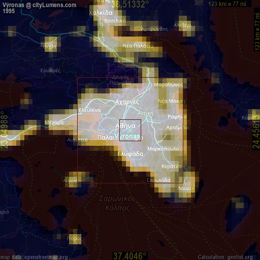
» NASA, Earths city lights 1995
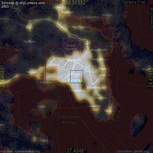
» NASA city lights 2003
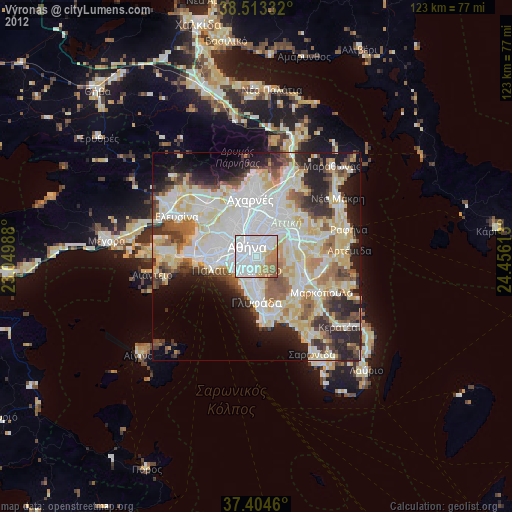
» Earth at Night: Flat Maps 2012, 2016