Néa Pentéli night lights from space
Night Light of Néa Pentéli (Attica) from space (Greece) Src. Average luminocity for 10x10km area is 77.5438% and for 50x50km: 43.0258%.
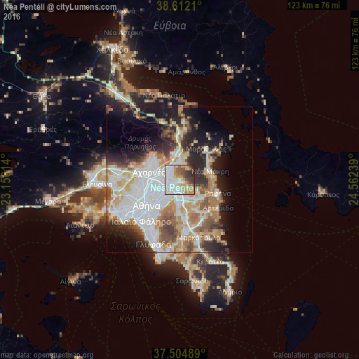
Analysis of Néa Pentéli night lights 2016
Square area 10x10 km:
 26.3%
26.3%90-99
19.97%80-89
9.09%70-79
12.5%60-69
8.28%50-59
6.17%40-49
4.06%30-39
8.12%20-29
5.52%10-19
0%0-9
0%Square area 50x50 km:
12.46%90-99
9.79%80-89
4.39%70-79
5.84%60-69
5.73%50-59
4.22%40-49
4.09%30-39
4%20-29
7.52%10-19
10.55%0-9
31.42%Clear (daylight) street map image can be seen on geolist.org.
Map coordinates:
38° 36' 43.6" North, 23° 9' 22.1" East
38° 3' 38.1" North, 23° 51' 33.3" East
37° 30' 17.6" North, 24° 33' 44.6" East
Some cities around Néa Pentéli sort by population:
• Maroúsi
5.3 km =3.3 mi,  257°
257°
• Agía Paraskeví
5.4 km =3.4 mi,  204°
204°
• Kifisiá
4.5 km =2.8 mi,  289°
289°
• Vrilissia
3.9 km =2.4 mi,  221°
221°
• Gérakas
4.2 km =2.6 mi,  181°
181°
• Melíssia
2.6 km =1.6 mi,  242°
242°
• Néa Erythraía
4.8 km =3 mi,  317°
317°
• Diónysos
5.2 km =3.2 mi,  19°
19°
9035866 (p: 7,198)
Sources (retrieved 2019-11-25):
» Earth at Night: Flat Maps 2012, 2016