Livadeiá night lights from space
Night Light of Livadeiá (Central Greece) from space (Greece) Src. Average luminocity for 10x10km area is 16.8555% and for 50x50km: 3.0807%.
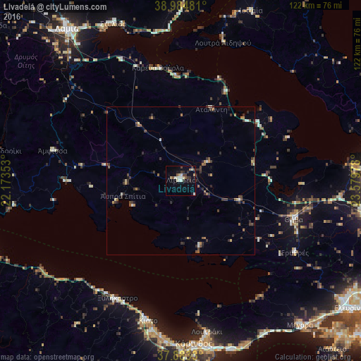
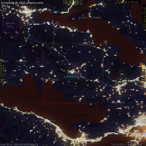
Analysis of Livadeiá night lights 2016
Square area 10x10 km:
 1.46%
1.46%90-99
3.9%80-89
3.73%70-79
0.49%60-69
0.16%50-59
1.95%40-49
1.14%30-39
5.36%20-29
1.3%10-19
8.12%0-9
72.4%Square area 50x50 km:
0.11%90-99
0.38%80-89
0.3%70-79
0.35%60-69
0.42%50-59
0.36%40-49
0.56%30-39
1.14%20-29
0.81%10-19
0.87%0-9
94.7%Clear (daylight) street map image can be seen on geolist.org.
Map coordinates:
38° 59' 5.3" North, 22° 10' 24.7" East
38° 26' 10.2" North, 22° 52' 35.9" East
37° 52' 59.9" North, 23° 34' 47.2" East
Some cities around Livadeiá sort by population:
• Kórinthos
55.5 km =34.5 mi,  173°
173°
• Thívai
40.5 km =25.2 mi,  107°
107°
• Loutráki
51.7 km =32.1 mi, 170°
• Kiáto
48.3 km =30 mi,  193°
193°
• Ámfissa
44.7 km =27.8 mi,  283°
283°
• Orchomenós
11 km =6.8 mi,  54°
54°
• Xylókastro
45.2 km =28.1 mi,  208°
208°
• Dhrosiá
58.7 km =36.5 mi,  84°
84°
258463 (p: 21,492)
Sources (retrieved 2019-11-25):
» Earth at Night: Flat Maps 2012, 2016