Ámfissa night lights from space
Night Light of Ámfissa (Central Greece) from space (Greece) Src. Average luminocity for 10x10km area is 5.1753% and for 50x50km: 1.6578%.
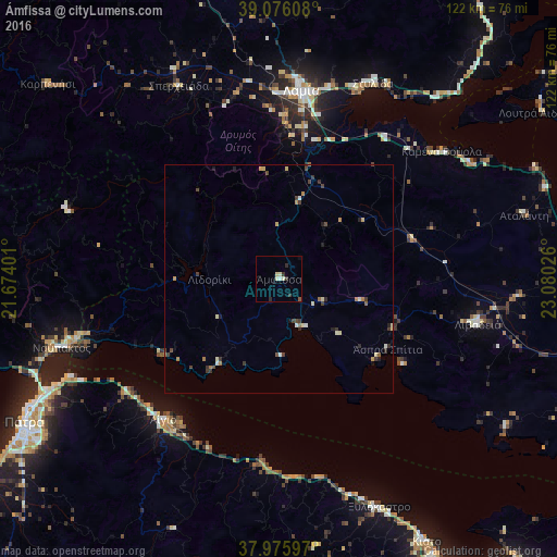
Analysis of Ámfissa night lights 2016
Square area 10x10 km:
 0.49%
0.49%90-99
1.95%80-89
0.81%70-79
0%60-69
0%50-59
0.65%40-49
0%30-39
1.95%20-29
1.3%10-19
0%0-9
92.86%Square area 50x50 km:
0.03%90-99
0.33%80-89
0.25%70-79
0.16%60-69
0.26%50-59
0.14%40-49
0.29%30-39
0.59%20-29
0.32%10-19
0.18%0-9
97.44%Clear (daylight) street map image can be seen on geolist.org.
Map coordinates:
39° 4' 33.9" North, 21° 40' 26.4" East
38° 31' 41.3" North, 22° 22' 37.7" East
37° 58' 33.5" North, 23° 4' 48.9" East
Some cities around Ámfissa sort by population:
• Pátra
64.3 km =40 mi,  240°
240°
• Lamía
41.6 km =25.8 mi,  6°
6°
• Livadeiá
44.7 km =27.8 mi,  103°
103°
• Aígio
40.3 km =25 mi,  219°
219°
• Náfpaktos
50.2 km =31.2 mi,  252°
252°
• Kiáto
65.8 km =40.9 mi,  150°
150°
• Orchomenós
52.6 km =32.7 mi,  94°
94°
• Xylókastro
54.8 km =34.1 mi,  156°
156°
265187 (p: 6,854)
Sources (retrieved 2019-11-25):
» Earth at Night: Flat Maps 2012, 2016