Kateríni night lights from space
Night Light of Kateríni (Central Macedonia) from space (Greece) Src. Average luminocity for 10x10km area is 43.3945% and for 50x50km: 5.2934%.
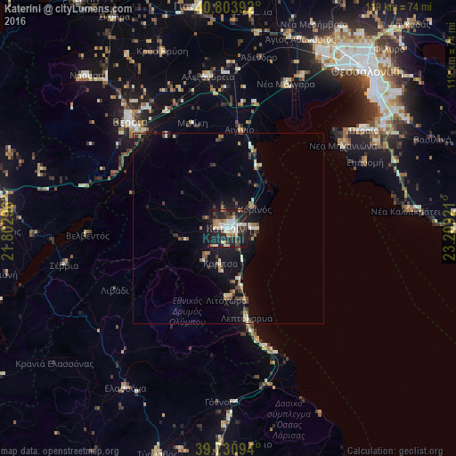
Analysis of Kateríni night lights 2016
Square area 10x10 km:
 7.14%
7.14%90-99
9.9%80-89
4.71%70-79
5.19%60-69
2.92%50-59
4.38%40-49
5.68%30-39
7.31%20-29
20.94%10-19
30.52%0-9
1.3%Square area 50x50 km:
0.43%90-99
0.83%80-89
0.48%70-79
0.5%60-69
0.74%50-59
0.56%40-49
0.8%30-39
1.11%20-29
1.25%10-19
4.81%0-9
88.48%Clear (daylight) street map image can be seen on geolist.org.
Map coordinates:
40° 48' 14.1" North, 21° 48' 10.7" East
40° 16' 10.4" North, 22° 30' 21.9" East
39° 43' 51.4" North, 23° 12' 33.2" East
Some cities around Kateríni sort by population:
• Véroia
38.3 km =23.8 mi,  317°
317°
• Peraía
43.8 km =27.2 mi,  54°
54°
• Alexándreia
40.1 km =24.9 mi,  352°
352°
• Epanomí
39.8 km =24.7 mi,  64°
64°
• Néa Michanióna
37.1 km =23.1 mi, 54°
• Chalástra
44.1 km =27.4 mi,  25°
25°
• Litóchoro
18.8 km =11.7 mi,  182°
182°
• Néoi Epivátes
42.8 km =26.6 mi, 53°
735914 (p: 53,293)
Sources (retrieved 2019-11-25):
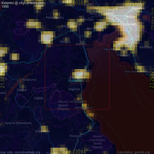
» NASA, Earths city lights 1995
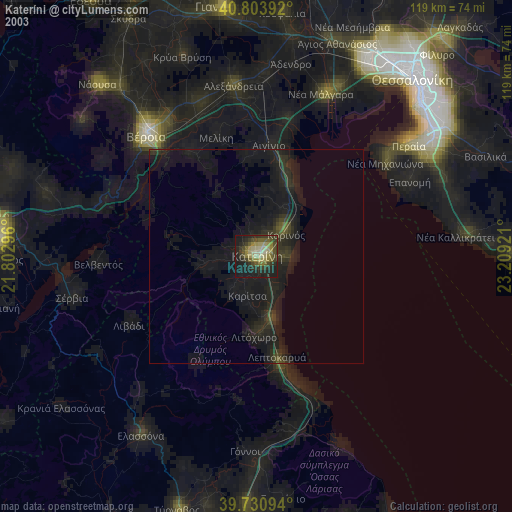
» NASA city lights 2003
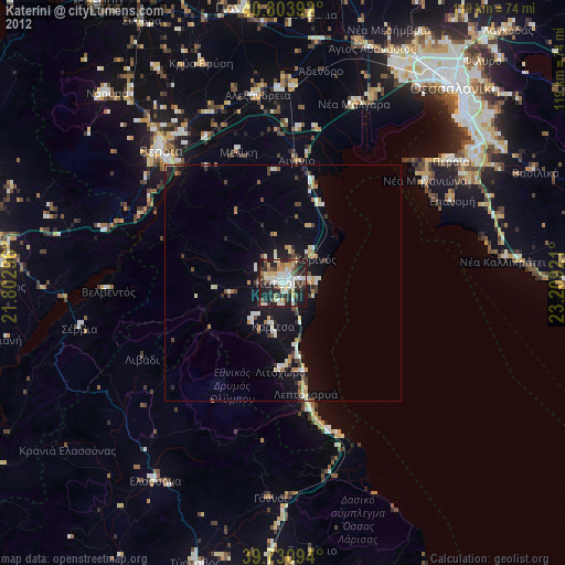
» Earth at Night: Flat Maps 2012, 2016