Khalándrion night lights from space
Night Light of Khalándrion (Attica) from space (Greece) Src. Average luminocity for 10x10km area is 98.0357% and for 50x50km: 47.883%.
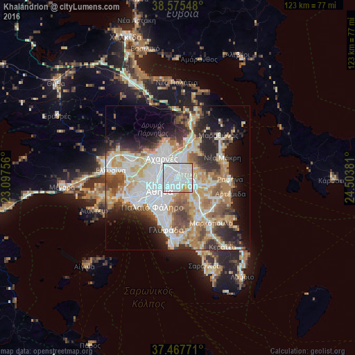

Analysis of Khalándrion night lights 2016
Square area 10x10 km:
 71.1%
71.1%90-99
21.1%80-89
3.73%70-79
3.9%60-69
0.16%50-59
0%40-49
0%30-39
0%20-29
0%10-19
0%0-9
0%Square area 50x50 km:
13.2%90-99
10.94%80-89
5.09%70-79
6.49%60-69
6.92%50-59
4.75%40-49
4.98%30-39
5.08%20-29
8.57%10-19
9.23%0-9
24.75%Clear (daylight) street map image can be seen on geolist.org.
Map coordinates:
38° 34' 31.7" North, 23° 5' 51.2" East
38° 1' 25.3" North, 23° 48' 2.4" East
37° 28' 3.8" North, 24° 30' 13.7" East
Some cities around Khalándrion sort by population:
• Maroúsi
2.9 km =1.8 mi,  358°
358°
• Néa Ionía
4 km =2.5 mi,  289°
289°
• Agía Paraskeví
3 km =1.9 mi,  105°
105°
• Cholargós
2.6 km =1.6 mi,  181°
181°
• Vrilissia
2.8 km =1.7 mi,  66°
66°
• Néo Psychikó
2.4 km =1.5 mi,  217°
217°
• Psychikó
2.7 km =1.7 mi,  245°
245°
• Filothéi
1.6 km =1 mi,  276°
276°
260172 (p: 74,192)
Sources (retrieved 2019-11-25):
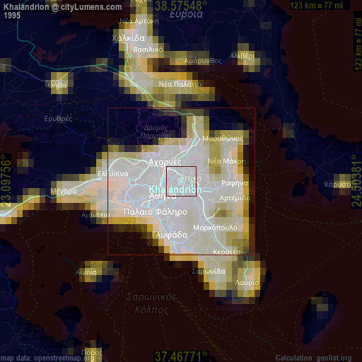
» NASA, Earths city lights 1995
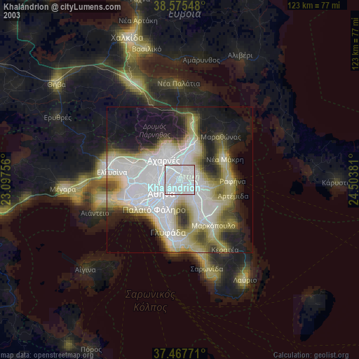
» NASA city lights 2003
» Earth at Night: Flat Maps 2012, 2016