Filothéi night lights from space
Night Light of Filothéi (Attica) from space (Greece) Src. Average luminocity for 10x10km area is 98.5341% and for 50x50km: 48.7542%.
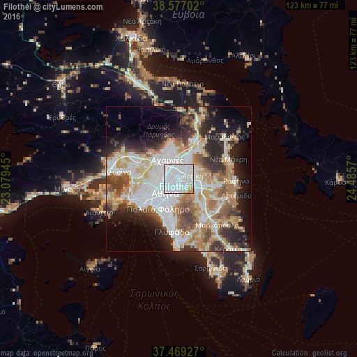
Analysis of Filothéi night lights 2016
Square area 10x10 km:
 78.9%
78.9%90-99
15.26%80-89
2.44%70-79
3.25%60-69
0.16%50-59
0%40-49
0%30-39
0%20-29
0%10-19
0%0-9
0%Square area 50x50 km:
13.41%90-99
11.08%80-89
5.17%70-79
6.56%60-69
7.12%50-59
4.88%40-49
5.17%30-39
5.24%20-29
8.81%10-19
9.34%0-9
23.22%Clear (daylight) street map image can be seen on geolist.org.
Map coordinates:
38° 34' 37.3" North, 23° 4' 46" East
38° 1' 30.9" North, 23° 46' 57.3" East
37° 28' 9.4" North, 24° 29' 8.5" East
Some cities around Filothéi sort by population:
• Khalándrion
1.6 km =1 mi,  96°
96°
• Maroúsi
3.1 km =1.9 mi,  29°
29°
• Néa Ionía
2.5 km =1.6 mi,  297°
297°
• Galátsi
3 km =1.9 mi,  251°
251°
• Irákleio
3.4 km =2.1 mi,  333°
333°
• Cholargós
3.2 km =2 mi,  151°
151°
• Néo Psychikó
2.1 km =1.3 mi,  177°
177°
• Psychikó
1.6 km =1 mi,  214°
214°
262398 (p: 7,302)
Sources (retrieved 2019-11-25):
» Earth at Night: Flat Maps 2012, 2016