Irákleio night lights from space
Night Light of Irákleio (Attica) from space (Greece) Src. Average luminocity for 10x10km area is 99.6607% and for 50x50km: 48.2322%.
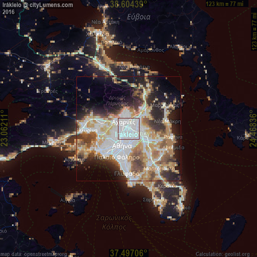
Analysis of Irákleio night lights 2016
Square area 10x10 km:
 82.79%
90-99
16.72%80-89
0.49%70-79
0%60-69
0%50-59
0%40-49
0%30-39
0%20-29
0%10-19
0%0-9
0%Square area 50x50 km:
13.24%90-99
10.73%80-89
5.05%70-79
6.68%60-69
6.82%50-59
4.93%40-49
5.25%30-39
5.01%20-29
8.52%10-19
11.27%0-9
22.48%Clear (daylight) street map image can be seen on geolist.org.
Map coordinates:
38° 36' 15.8" North, 23° 3' 43.6" East
38° 3' 10.2" North, 23° 45' 54.8" East
37° 29' 49.4" North, 24° 28' 6.1" East
Some cities around Irákleio sort by population:
• Maroúsi
3.1 km =1.9 mi,  95°
95°
• Néa Ionía
2 km =1.2 mi,  199°
199°
• Galátsi
4.2 km =2.6 mi, 198°
• Metamórfosi
1.4 km =0.9 mi,  354°
354°
• Néa Filadélfeia
3.1 km =1.9 mi,  230°
230°
• Péfki
2.5 km =1.6 mi,  71°
71°
• Lykóvrysi
2.4 km =1.5 mi,  39°
39°
• Filothéi
3.4 km =2.1 mi,  153°
153°
261743 (p: 49,642)
Sources (retrieved 2019-11-25):
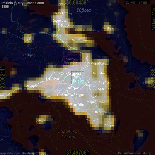
» NASA, Earths city lights 1995
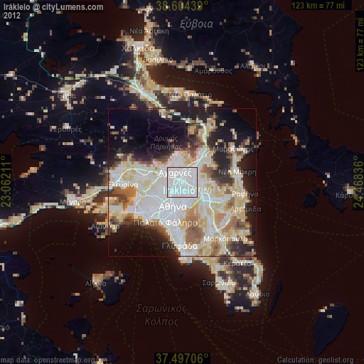
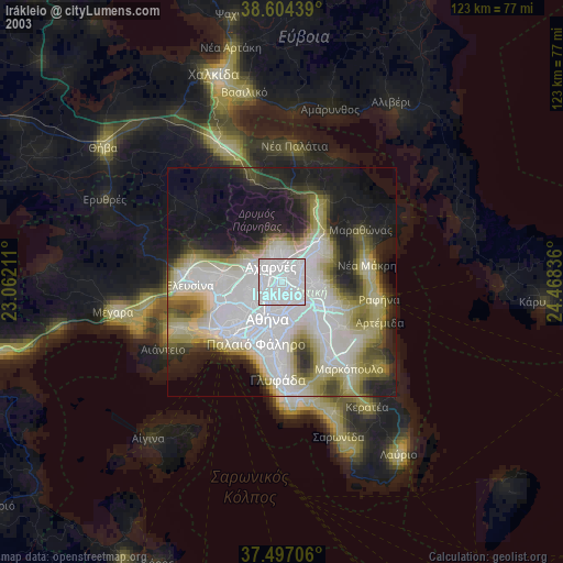
» NASA city lights 2003
» Earth at Night: Flat Maps 2012, 2016