Asvestochóri night lights from space
Night Light of Asvestochóri (Central Macedonia) from space (Greece) Src. Average luminocity for 10x10km area is 53.1591% and for 50x50km: 20.8905%.
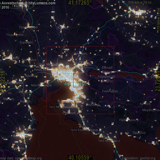
Analysis of Asvestochóri night lights 2016
Square area 10x10 km:
 9.9%
9.9%90-99
13.96%80-89
3.25%70-79
6.98%60-69
11.36%50-59
5.19%40-49
6.66%30-39
8.12%20-29
12.66%10-19
18.18%0-9
3.73%Square area 50x50 km:
4%90-99
4.43%80-89
2%70-79
2.15%60-69
2.99%50-59
2.21%40-49
2.43%30-39
3.65%20-29
5.96%10-19
10.29%0-9
59.89%Clear (daylight) street map image can be seen on geolist.org.
Map coordinates:
41° 10' 21.5" North, 22° 19' 19.8" East
40° 38' 28.5" North, 23° 1' 31" East
40° 6' 20.1" North, 23° 43' 42.3" East
Some cities around Asvestochóri sort by population:
• Thessaloníki
8 km =5 mi,  271°
271°
• Sykiés
6.3 km =3.9 mi,  278°
278°
• Políchni
7 km =4.3 mi,  293°
293°
• Neapoli
7.2 km =4.5 mi, 280°
• Pylaía
5.7 km =3.5 mi,  215°
215°
• Panórama
6 km =3.7 mi,  174°
174°
• Triandría
5.1 km =3.2 mi,  234°
234°
• Ágios Pávlos
5.5 km =3.4 mi, 269°
736687 (p: 6,404)
Sources (retrieved 2019-11-25):
» Earth at Night: Flat Maps 2012, 2016