Políchni night lights from space
Night Light of Políchni (Central Macedonia) from space (Greece) Src. Average luminocity for 10x10km area is 84.1023% and for 50x50km: 21.1172%.
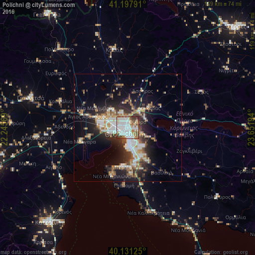
Analysis of Políchni night lights 2016
Square area 10x10 km:
 37.66%
90-99
24.19%80-89
4.87%70-79
5.68%60-69
10.39%50-59
6.33%40-49
5.19%30-39
5.52%20-29
0.16%10-19
0%0-9
0%Square area 50x50 km:
4%90-99
4.49%80-89
2.04%70-79
2.26%60-69
2.78%50-59
2.18%40-49
2.44%30-39
3.76%20-29
6.12%10-19
10.43%0-9
59.51%Clear (daylight) street map image can be seen on geolist.org.
Map coordinates:
41° 11' 52.5" North, 22° 14' 44.5" East
40° 40' 0.2" North, 22° 56' 55.7" East
40° 7' 52.5" North, 23° 39' 7" East
Some cities around Políchni sort by population:
• Thessaloníki
3 km =1.9 mi,  210°
210°
• Sykiés
1.9 km =1.2 mi,  174°
174°
• Neapoli
1.6 km =1 mi,  202°
202°
• Meneméni
4.5 km =2.8 mi,  257°
257°
• Oraiókastro
7.6 km =4.7 mi,  339°
339°
• Triandría
6.2 km =3.9 mi,  158°
158°
• Ágios Pávlos
3 km =1.9 mi, 161°
• Asvestochóri
7 km =4.3 mi,  113°
113°
734538 (p: 39,765)
Sources (retrieved 2019-11-25):
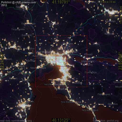
» Earth at Night: Flat Maps 2012, 2016