Zugdidi night lights from space
Night Light of Zugdidi (Samegrelo and Zemo Svaneti) from space (Georgia) Src. Average luminocity for 10x10km area is 29.227% and for 50x50km: 2.5468%.
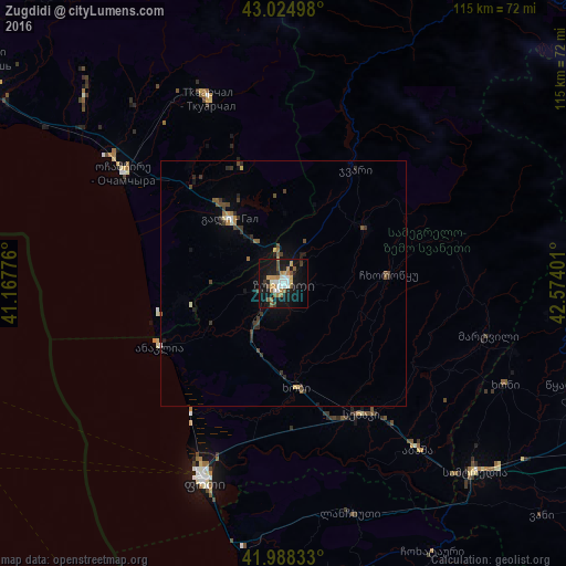
Analysis of Zugdidi night lights 2016
Square area 10x10 km:
 4.13%
4.13%90-99
5.4%80-89
1.9%70-79
4.29%60-69
5.24%50-59
3.65%40-49
3.02%30-39
2.54%20-29
3.49%10-19
36.51%0-9
29.84%Square area 50x50 km:
0.18%90-99
0.3%80-89
0.18%70-79
0.28%60-69
0.37%50-59
0.36%40-49
0.55%30-39
0.56%20-29
0.64%10-19
1.95%0-9
94.64%Clear (daylight) street map image can be seen on geolist.org.
Map coordinates:
43° 1' 29.9" North, 41° 10' 3.9" East
42° 30' 31.7" North, 41° 52' 15.2" East
41° 59' 18" North, 42° 34' 26.4" East
Some cities around Zugdidi sort by population:
• P’ot’i
43.8 km =27.2 mi,  201°
201°
• Senak’i
31 km =19.3 mi,  148°
148°
• Tqvarch'eli
40 km =24.9 mi,  337°
337°
• Och’amch’ire
39.9 km =24.8 mi,  304°
304°
• Gali
17 km =10.6 mi,  320°
320°
• Tsalenjikha
19.3 km =12 mi,  56°
56°
• Mart’vili
43 km =26.7 mi,  104°
104°
• Khobi
21.6 km =13.4 mi,  173°
173°
610824 (p: 73,006)
Sources (retrieved 2019-11-25):
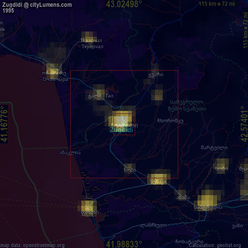
» NASA, Earths city lights 1995
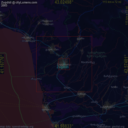
» NASA city lights 2003
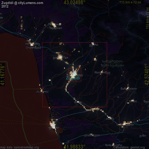
» Earth at Night: Flat Maps 2012, 2016