Och’amch’ire night lights from space
Night Light of Och’amch’ire (Abkhazia) from space (Georgia) Src. Average luminocity for 10x10km area is 8.9576% and for 50x50km: 1.6495%.
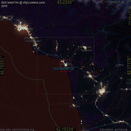
Analysis of Och’amch’ire night lights 2016
Square area 10x10 km:
 1.36%
1.36%90-99
0.76%80-89
2.42%70-79
0.91%60-69
1.97%50-59
0.61%40-49
0.91%30-39
0.15%20-29
0.45%10-19
1.36%0-9
89.09%Square area 50x50 km:
0.06%90-99
0.15%80-89
0.19%70-79
0.19%60-69
0.28%50-59
0.16%40-49
0.41%30-39
0.49%20-29
0.44%10-19
0.45%0-9
97.17%Clear (daylight) street map image can be seen on geolist.org.
Map coordinates:
43° 13' 36.5" North, 40° 45' 55.8" East
42° 42' 44.4" North, 41° 28' 7.1" East
42° 11' 36.7" North, 42° 10' 18.3" East
Some cities around Och’amch’ire sort by population:
• Sokhumi
51 km =31.7 mi,  309°
309°
• Zugdidi
39.9 km =24.8 mi,  124°
124°
• P’ot’i
65.5 km =40.7 mi,  165°
165°
• Stantsiya Novyy Afon
65.7 km =40.8 mi, 308°
• Tqvarch'eli
22.4 km =13.9 mi,  50°
50°
• Gali
24 km =14.9 mi,  113°
113°
• Tsalenjikha
50.5 km =31.4 mi,  103°
103°
• Khobi
56.5 km =35.1 mi,  141°
141°
612652 (p: 15,517)
Sources (retrieved 2019-11-25):
» Earth at Night: Flat Maps 2012, 2016