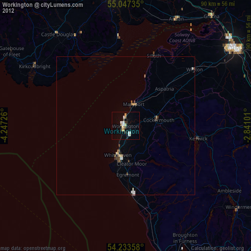
Workington night lights from space
Night Light of Workington (England) from space (United Kingdom) Src. Average luminocity for 10x10km area is 15.6103% and for 50x50km: 1.4783%.
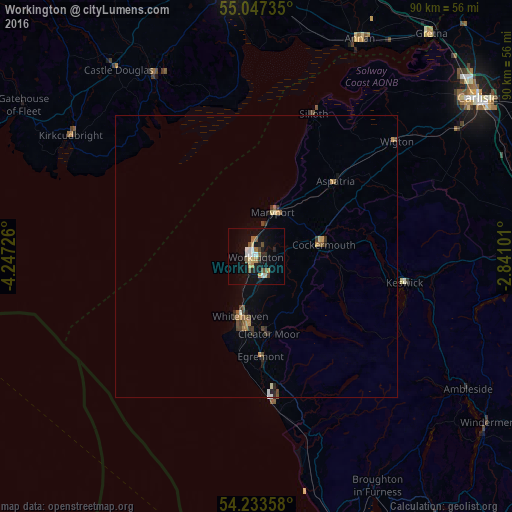
Analysis of Workington night lights 2016
Square area 10x10 km:
 1.88%
1.88%90-99
2.51%80-89
1.5%70-79
2.51%60-69
1%50-59
2.26%40-49
2.63%30-39
1%20-29
2.26%10-19
12.41%0-9
70.05%Square area 50x50 km:
0.1%90-99
0.14%80-89
0.14%70-79
0.25%60-69
0.19%50-59
0.26%40-49
0.3%30-39
0.27%20-29
0.24%10-19
0.62%0-9
97.5%Clear (daylight) street map image can be seen on geolist.org.
Map coordinates:
55° 2' 50.5" North, 4° 14' 50.1" West
54° 38' 33" North, 3° 32' 38.9" West
54° 14' 0.9" North, 2° 50' 27.6" West
Some cities around Workington sort by population:
• Whitehaven
10.7 km =6.6 mi,  193°
193°
• Maryport
8.6 km =5.3 mi,  21°
21°
• Cockermouth
12 km =7.5 mi,  79°
79°
• Annan
42.6 km =26.5 mi,  25°
25°
• Cleator Moor
13.6 km =8.5 mi,  172°
172°
• Denton Holme
47.2 km =29.3 mi,  55°
55°
• Egremont
18.2 km =11.3 mi,  176°
176°
• Wigton
31.9 km =19.8 mi,  50°
50°
2633553 (p: 27,120)
Sources (retrieved 2019-11-25):
» Earth at Night: Flat Maps 2012, 2016