Egremont night lights from space
Night Light of Egremont (England) from space (United Kingdom) Src. Average luminocity for 10x10km area is 3.6017% and for 50x50km: 1.3994%.
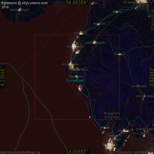
Analysis of Egremont night lights 2016
Square area 10x10 km:
 0%
0%90-99
0%80-89
0.24%70-79
0.48%60-69
0.48%50-59
0%40-49
1.08%30-39
1.56%20-29
1.44%10-19
0.72%0-9
94.02%Square area 50x50 km:
0.11%90-99
0.14%80-89
0.14%70-79
0.19%60-69
0.14%50-59
0.25%40-49
0.32%30-39
0.23%20-29
0.24%10-19
0.57%0-9
97.66%Clear (daylight) street map image can be seen on geolist.org.
Map coordinates:
54° 53' 9.2" North, 4° 13' 50.4" West
54° 28' 45.9" North, 3° 31' 39.2" West
54° 4' 7.9" North, 2° 49' 27.9" West
Some cities around Egremont sort by population:
• Workington
18.2 km =11.3 mi,  356°
356°
• Whitehaven
8.6 km =5.3 mi,  334°
334°
• Ulverston
42.1 km =26.2 mi,  138°
138°
• Maryport
26.2 km =16.3 mi,  4°
4°
• Cockermouth
23 km =14.3 mi,  27°
27°
• Windermere
41.6 km =25.8 mi,  105°
105°
• Cleator Moor
4.7 km =2.9 mi,  9°
9°
• Millom
34.2 km =21.3 mi,  150°
150°
2650174 (p: 6,222)
Sources (retrieved 2019-11-25):
» Earth at Night: Flat Maps 2012, 2016