Ashton in Makerfield night lights from space
Night Light of Ashton in Makerfield (England) from space (United Kingdom) Src. Average luminocity for 10x10km area is 61.9802% and for 50x50km: 48.0655%.
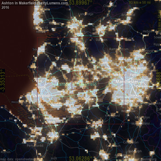
Analysis of Ashton in Makerfield night lights 2016
Square area 10x10 km:
 7.41%
7.41%90-99
9.13%80-89
9.13%70-79
10.05%60-69
10.19%50-59
17.99%40-49
17.99%30-39
16.8%20-29
1.32%10-19
0%0-9
0%Square area 50x50 km:
12.15%90-99
11%80-89
4.64%70-79
4.63%60-69
5.54%50-59
5.22%40-49
6.89%30-39
7.72%20-29
11.69%10-19
16.07%0-9
14.44%Clear (daylight) street map image can be seen on geolist.org.
Map coordinates:
53° 53' 58.8" North, 3° 21' 11.3" West
53° 28' 60" North, 2° 39' 0" West
53° 3' 46.3" North, 1° 56' 48.8" West
Some cities around Ashton in Makerfield sort by population:
• Wigan
6.7 km =4.2 mi,  7°
7°
• St Helens
6.6 km =4.1 mi,  236°
236°
• Golborne
3.6 km =2.2 mi,  101°
101°
• Newton-le-Willows
5 km =3.1 mi,  138°
138°
• Haydock
2.8 km =1.7 mi,  229°
229°
• Ince-in-Makerfield
6 km =3.7 mi,  21°
21°
• Abram
4.7 km =2.9 mi,  53°
53°
• Billinge
4.2 km =2.6 mi,  292°
292°
2656918 (p: 29,039)
Sources (retrieved 2019-11-25):
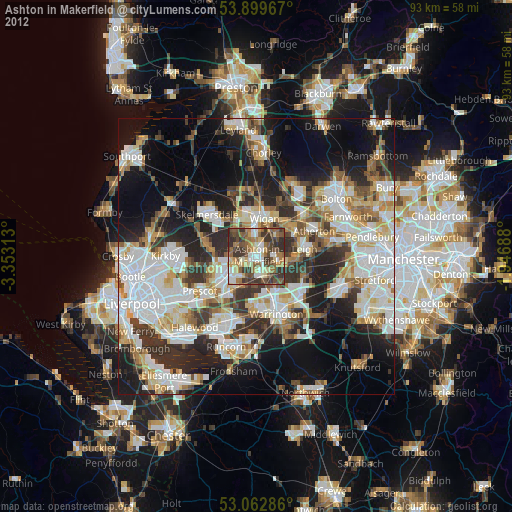
» Earth at Night: Flat Maps 2012, 2016