Honiton night lights from space
Night Light of Honiton (England) from space (United Kingdom) Src. Average luminocity for 10x10km area is 1.9902% and for 50x50km: 3.8081%.
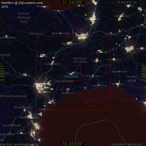
Analysis of Honiton night lights 2016
Square area 10x10 km:
 0%
0%90-99
0%80-89
0.7%70-79
0.42%60-69
0.7%50-59
0.42%40-49
0%30-39
0%20-29
0.56%10-19
0%0-9
97.2%Square area 50x50 km:
0.35%90-99
0.7%80-89
0.48%70-79
0.4%60-69
0.48%50-59
0.59%40-49
0.46%30-39
0.57%20-29
0.59%10-19
2.93%0-9
92.45%Clear (daylight) street map image can be seen on geolist.org.
Map coordinates:
51° 14' 30.8" North, 3° 53' 31.6" West
50° 47' 58.6" North, 3° 11' 20.4" West
50° 21' 11.1" North, 2° 29' 9.1" West
Some cities around Honiton sort by population:
• Heavitree
23.3 km =14.5 mi,  247°
247°
• Tiverton
24.2 km =15 mi,  298°
298°
• Chard
17.6 km =10.9 mi,  62°
62°
• Sidmouth
12.6 km =7.8 mi,  196°
196°
• Cullompton
15.6 km =9.7 mi,  293°
293°
• Ilminster
24.2 km =15 mi,  54°
54°
• Axminster
13.6 km =8.5 mi,  98°
98°
• Budleigh Salterton
21.1 km =13.1 mi,  206°
206°
2646658 (p: 11,483)
Sources (retrieved 2019-11-25):
» Earth at Night: Flat Maps 2012, 2016