Stevenage night lights from space
Night Light of Stevenage (England) from space (United Kingdom) Src. Average luminocity for 10x10km area is 25.3056% and for 50x50km: 20.0017%.
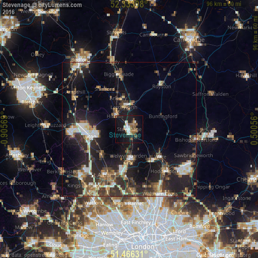
Analysis of Stevenage night lights 2016
Square area 10x10 km:
 2.78%
2.78%90-99
4.55%80-89
1.14%70-79
1.52%60-69
4.29%50-59
8.08%40-49
2.02%30-39
1.14%20-29
1.64%10-19
38.26%0-9
34.6%Square area 50x50 km:
2.31%90-99
3.04%80-89
1.98%70-79
1.76%60-69
2.55%50-59
2.97%40-49
3.3%30-39
4.58%20-29
7.98%10-19
16.22%0-9
53.3%Clear (daylight) street map image can be seen on geolist.org.
Map coordinates:
52° 20' 2.3" North, 0° 54' 20.5" West
51° 54' 8.1" North, 0° 12' 9.2" West
51° 27' 58.7" North, 0° 30' 2" East
Some cities around Stevenage sort by population:
• Welwyn Garden City
11.2 km =7 mi,  181°
181°
• Letchworth Garden City
8.7 km =5.4 mi,  349°
349°
• Hitchin
7.7 km =4.8 mi,  312°
312°
• Letchworth
8.8 km =5.5 mi, 348°
• Codicote
6.2 km =3.9 mi,  202°
202°
• Baldock
9.6 km =6 mi,  5°
5°
• Stotfold
12.8 km =8 mi, 350°
• Arlesey
12.4 km =7.7 mi,  339°
339°
2636940 (p: 90,232)
Sources (retrieved 2019-11-25):
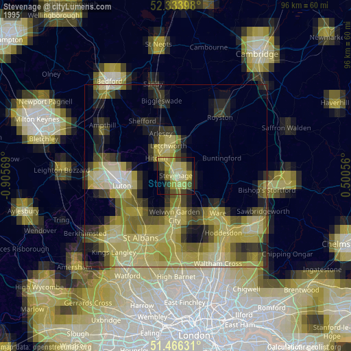
» NASA, Earths city lights 1995
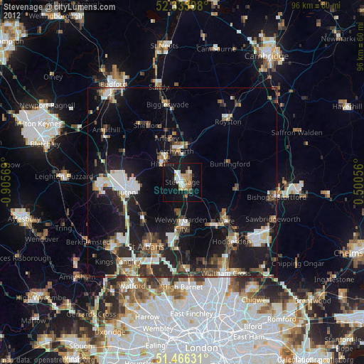
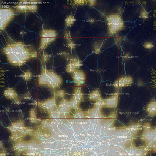
» NASA city lights 2003
» Earth at Night: Flat Maps 2012, 2016