Sawston night lights from space
Night Light of Sawston (England) from space (United Kingdom) Src. Average luminocity for 10x10km area is 8.2024% and for 50x50km: 5.4208%.
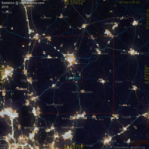
Analysis of Sawston night lights 2016
Square area 10x10 km:
 0%
0%90-99
0%80-89
0%70-79
0.13%60-69
1.72%50-59
0.93%40-49
1.46%30-39
4.1%20-29
3.84%10-19
11.77%0-9
76.06%Square area 50x50 km:
0.46%90-99
0.63%80-89
0.53%70-79
0.44%60-69
0.83%50-59
1.1%40-49
0.89%30-39
0.87%20-29
1.08%10-19
4.16%0-9
89.02%Clear (daylight) street map image can be seen on geolist.org.
Map coordinates:
52° 33' 1.9" North, 0° 32' 1.3" West
52° 7' 15.2" North, 0° 10' 9.9" East
51° 41' 13.5" North, 0° 52' 21.2" East
Some cities around Sawston sort by population:
• Cambridge
9.5 km =5.9 mi,  337°
337°
• Haverhill
18.9 km =11.7 mi,  103°
103°
• Royston
15.5 km =9.6 mi,  238°
238°
• Saffron Walden
11.9 km =7.4 mi,  155°
155°
• Cambourne
19.8 km =12.3 mi,  304°
304°
• Histon
15.2 km =9.4 mi, 343°
• Cottenham
18.8 km =11.7 mi,  350°
350°
• Waterbeach
16.2 km =10.1 mi,  5°
5°
2638474 (p: 7,275)
Sources (retrieved 2019-11-25):
» Earth at Night: Flat Maps 2012, 2016