Cottenham night lights from space
Night Light of Cottenham (England) from space (United Kingdom) Src. Average luminocity for 10x10km area is 8.1818% and for 50x50km: 6.0415%.
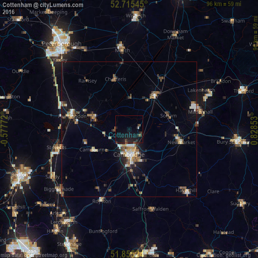
Analysis of Cottenham night lights 2016
Square area 10x10 km:
 0.13%
0.13%90-99
0.38%80-89
0%70-79
0%60-69
0.88%50-59
1.01%40-49
1.64%30-39
2.02%20-29
4.29%10-19
18.18%0-9
71.46%Square area 50x50 km:
0.55%90-99
0.83%80-89
0.49%70-79
0.54%60-69
0.84%50-59
1.1%40-49
0.88%30-39
1.03%20-29
1.26%10-19
4.35%0-9
88.13%Clear (daylight) street map image can be seen on geolist.org.
Map coordinates:
52° 42' 55.6" North, 0° 34' 39.8" West
52° 17' 14.7" North, 0° 7' 31.4" East
51° 51' 18.9" North, 0° 49' 42.7" East
Some cities around Cottenham sort by population:
• Cambridge
9.7 km =6 mi,  183°
183°
• Ely
15.5 km =9.6 mi,  36°
36°
• Soham
15.3 km =9.5 mi,  69°
69°
• Cambourne
15.2 km =9.4 mi,  241°
241°
• Histon
4.2 km =2.6 mi,  197°
197°
• Sawston
18.8 km =11.7 mi,  170°
170°
• Burwell
13.8 km =8.6 mi,  95°
95°
• Waterbeach
5.1 km =3.2 mi,  118°
118°
2652269 (p: 5,903)
Sources (retrieved 2019-11-25):
» Earth at Night: Flat Maps 2012, 2016