Cambridge night lights from space
Night Light of Cambridge (England) from space (United Kingdom) Src. Average luminocity for 10x10km area is 42.2646% and for 50x50km: 6.5528%.
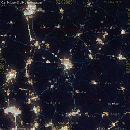
Analysis of Cambridge night lights 2016
Square area 10x10 km:
 7.41%
7.41%90-99
7.54%80-89
5.95%70-79
5.42%60-69
6.75%50-59
7.94%40-49
4.23%30-39
1.85%20-29
11.51%10-19
24.87%0-9
16.53%Square area 50x50 km:
0.62%90-99
0.88%80-89
0.66%70-79
0.64%60-69
0.87%50-59
1.07%40-49
1.01%30-39
1.18%20-29
1.25%10-19
4.54%0-9
87.29%Clear (daylight) street map image can be seen on geolist.org.
Map coordinates:
52° 37' 43.9" North, 0° 35' 11.3" West
52° 12' 0" North, 0° 7' 0" East
51° 46' 1.1" North, 0° 49' 11.2" East
Some cities around Cambridge sort by population:
• Newmarket
20.2 km =12.6 mi,  75°
75°
• Royston
19.4 km =12.1 mi,  209°
209°
• Cambourne
13 km =8.1 mi,  280°
280°
• Histon
5.8 km =3.6 mi,  353°
353°
• Sawston
9.5 km =5.9 mi,  157°
157°
• Burwell
16.7 km =10.4 mi,  59°
59°
• Cottenham
9.7 km =6 mi,  3°
3°
• Waterbeach
8.9 km =5.5 mi,  34°
34°
2653941 (p: 158,434)
Sources (retrieved 2019-11-25):
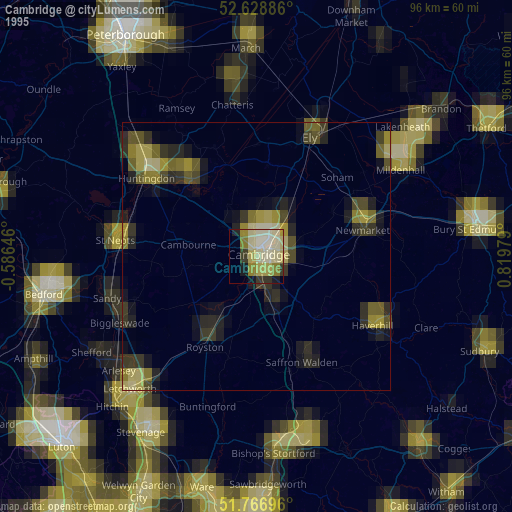
» NASA, Earths city lights 1995
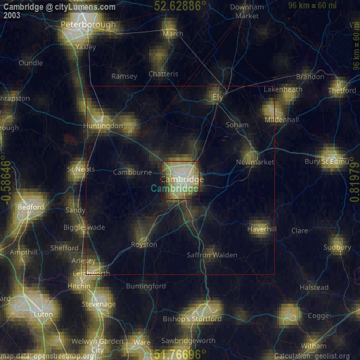
» NASA city lights 2003
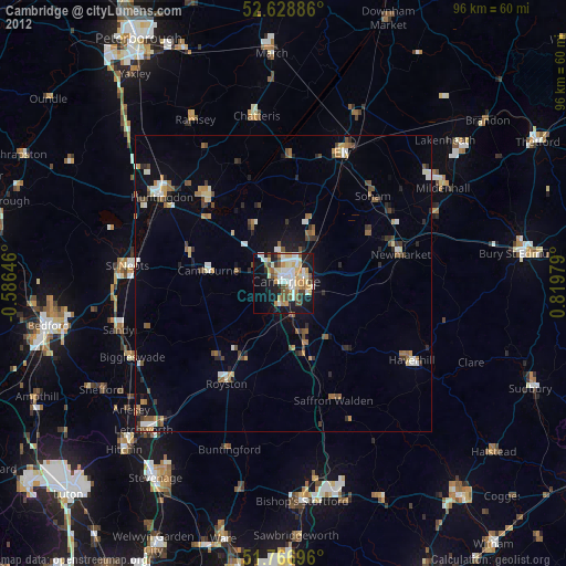
» Earth at Night: Flat Maps 2012, 2016