Histon night lights from space
Night Light of Histon (England) from space (United Kingdom) Src. Average luminocity for 10x10km area is 29.8135% and for 50x50km: 6.4624%.
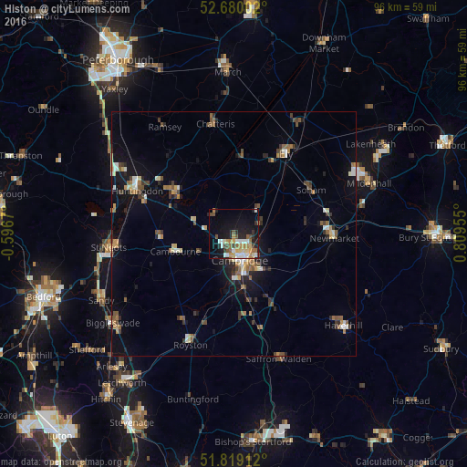
Analysis of Histon night lights 2016
Square area 10x10 km:
 4.63%
4.63%90-99
4.89%80-89
3.7%70-79
3.57%60-69
4.37%50-59
3.57%40-49
4.76%30-39
2.51%20-29
6.48%10-19
24.6%0-9
36.9%Square area 50x50 km:
0.57%90-99
0.84%80-89
0.62%70-79
0.67%60-69
0.88%50-59
1.14%40-49
0.96%30-39
1.05%20-29
1.29%10-19
4.36%0-9
87.63%Clear (daylight) street map image can be seen on geolist.org.
Map coordinates:
52° 40' 48.1" North, 0° 35' 48.1" West
52° 15' 6" North, 0° 6' 23.1" East
51° 49' 8.8" North, 0° 48' 34.4" East
Some cities around Histon sort by population:
• Cambridge
5.8 km =3.6 mi,  173°
173°
• Ely
19.6 km =12.2 mi,  32°
32°
• Soham
18.2 km =11.3 mi,  59°
59°
• Cambourne
12.5 km =7.8 mi,  254°
254°
• Sawston
15.2 km =9.4 mi,  163°
163°
• Burwell
15.3 km =9.5 mi,  79°
79°
• Cottenham
4.2 km =2.6 mi,  17°
17°
• Waterbeach
6 km =3.7 mi, 75°
2646828 (p: 7,592)
Sources (retrieved 2019-11-25):
» Earth at Night: Flat Maps 2012, 2016