Otford night lights from space
Night Light of Otford (England) from space (United Kingdom) Src. Average luminocity for 10x10km area is 15.1751% and for 50x50km: 38.3936%.
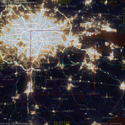
Analysis of Otford night lights 2016
Square area 10x10 km:
 0%
0%90-99
0.56%80-89
0.84%70-79
1.4%60-69
1.82%50-59
4.9%40-49
4.62%30-39
5.6%20-29
3.36%10-19
12.32%0-9
64.57%Square area 50x50 km:
13.84%90-99
7.84%80-89
3.69%70-79
3.75%60-69
3.84%50-59
3.08%40-49
3.34%30-39
4.15%20-29
6.43%10-19
10.77%0-9
39.26%Clear (daylight) street map image can be seen on geolist.org.
Map coordinates:
51° 45' 0.8" North, 0° 30' 45.6" West
51° 18' 46.2" North, 0° 11' 25.7" East
50° 52' 16.4" North, 0° 53' 36.9" East
Some cities around Otford sort by population:
• Sevenoaks
4.5 km =2.8 mi,  181°
181°
• Swanley
9.5 km =5.9 mi,  352°
352°
• Hartley
11.4 km =7.1 mi,  43°
43°
• Orpington
9.4 km =5.8 mi,  316°
316°
• Biggin Hill
10.9 km =6.8 mi,  270°
270°
• Farnborough
9.9 km =6.2 mi,  301°
301°
• Kemsing
2.8 km =1.7 mi,  105°
105°
• West Kingsdown
5.9 km =3.7 mi,  55°
55°
2640860 (p: 7,155)
Sources (retrieved 2019-11-25):
» Earth at Night: Flat Maps 2012, 2016