Newmains night lights from space
Night Light of Newmains (Scotland) from space (United Kingdom) Src. Average luminocity for 10x10km area is 33.0933% and for 50x50km: 24.164%.
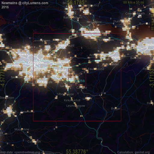
Analysis of Newmains night lights 2016
Square area 10x10 km:
 3.71%
3.71%90-99
5.62%80-89
1.56%70-79
3.47%60-69
6.7%50-59
5.5%40-49
8.01%30-39
6.46%20-29
12.92%10-19
16.51%0-9
29.55%Square area 50x50 km:
6.08%90-99
6.03%80-89
1.61%70-79
2.3%60-69
2.42%50-59
2.23%40-49
2.61%30-39
3.28%20-29
6.92%10-19
11.51%0-9
55.01%Clear (daylight) street map image can be seen on geolist.org.
Map coordinates:
56° 10' 42.6" North, 4° 34' 40" West
55° 47' 6.5" North, 3° 52' 28.7" West
55° 23' 15.9" North, 3° 10' 17.5" West
Some cities around Newmains sort by population:
• Motherwell
7.3 km =4.5 mi,  273°
273°
• Wishaw
3.3 km =2.1 mi,  231°
231°
• Dalserf
6.3 km =3.9 mi,  204°
204°
• Carluke
6.1 km =3.8 mi,  153°
153°
• Shotts
6.2 km =3.9 mi,  51°
51°
• Newarthill
5.1 km =3.2 mi,  310°
310°
• New Stevenston
7.1 km =4.4 mi,  299°
299°
• Holytown
7.3 km =4.5 mi, 302°
2641618 (p: 5,710)
Sources (retrieved 2019-11-25):
» Earth at Night: Flat Maps 2012, 2016