Montrose night lights from space
Night Light of Montrose (Scotland) from space (United Kingdom) Src. Average luminocity for 10x10km area is 8.3286% and for 50x50km: 0.9792%.
Analysis of Montrose night lights 2016
Square area 10x10 km:
 1.55%
1.55%90-99
2.26%80-89
0.95%70-79
0.95%60-69
0.48%50-59
0.95%40-49
0%30-39
0%20-29
0.48%10-19
0.83%0-9
91.55%Square area 50x50 km:
0.1%90-99
0.12%80-89
0.08%70-79
0.15%60-69
0.18%50-59
0.12%40-49
0.13%30-39
0.06%20-29
0.14%10-19
0.26%0-9
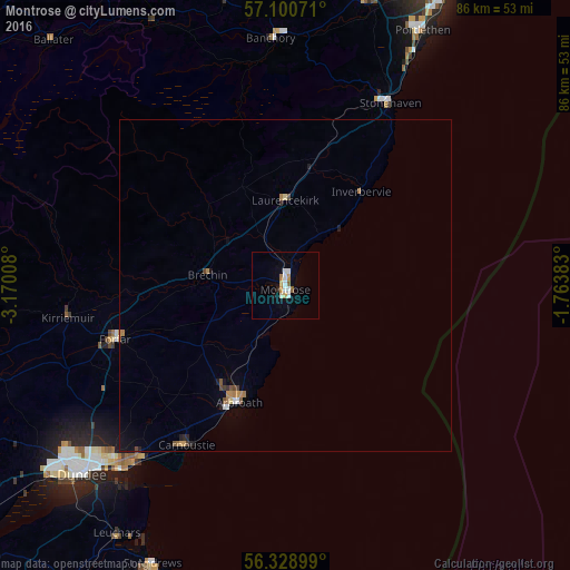
98.65%Clear (daylight) street map image can be seen on geolist.org.
Map coordinates:
57° 6' 2.6" North, 3° 10' 12.3" West
56° 43' 0.6" North, 2° 28' 1" West
56° 19' 44.4" North, 1° 45' 49.8" West
Some cities around Montrose sort by population:
• Arbroath
18.6 km =11.6 mi,  203°
203°
• Forfar
27.1 km =16.8 mi,  252°
252°
• Carnoustie
27.9 km =17.3 mi,  211°
211°
• Stonehaven
31.5 km =19.6 mi,  29°
29°
• Monifieth
33.8 km =21 mi,  219°
219°
• Banchory
37.3 km =23.2 mi,  358°
358°
• Brechin
11.7 km =7.3 mi,  277°
277°
• Kirriemuir
33.1 km =20.6 mi,  261°
261°
2642302 (p: 11,880)
Sources (retrieved 2019-11-25):
» Earth at Night: Flat Maps 2012, 2016