Brechin night lights from space
Night Light of Brechin (Scotland) from space (United Kingdom) Src. Average luminocity for 10x10km area is 0.7107% and for 50x50km: 1.3267%.
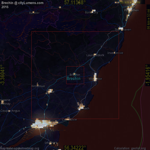
Analysis of Brechin night lights 2016
Square area 10x10 km:
 0%
0%90-99
0%80-89
0%70-79
0%60-69
0.48%50-59
0%40-49
0.48%30-39
0%20-29
0%10-19
0.48%0-9
98.57%Square area 50x50 km:
0.12%90-99
0.15%80-89
0.09%70-79
0.14%60-69
0.21%50-59
0.15%40-49
0.17%30-39
0.11%20-29
0.36%10-19
1.03%0-9
97.47%Clear (daylight) street map image can be seen on geolist.org.
Map coordinates:
57° 6' 49.2" North, 3° 21' 37.5" West
56° 43' 47.7" North, 2° 39' 26.2" West
56° 20' 32" North, 1° 57' 15" West
Some cities around Brechin sort by population:
• Dundee
34.9 km =21.7 mi,  213°
213°
• Arbroath
19 km =11.8 mi,  167°
167°
• Forfar
17.1 km =10.6 mi,  236°
236°
• Montrose
11.7 km =7.3 mi,  97°
97°
• Carnoustie
25.4 km =15.8 mi,  186°
186°
• Monifieth
29.2 km =18.1 mi,  199°
199°
• Banchory
37.2 km =23.1 mi,  16°
16°
• Kirriemuir
22 km =13.7 mi,  253°
253°
2654824 (p: 7,520)
Sources (retrieved 2019-11-25):
» Earth at Night: Flat Maps 2012, 2016