Carnoustie night lights from space
Night Light of Carnoustie (Scotland) from space (United Kingdom) Src. Average luminocity for 10x10km area is 2.3648% and for 50x50km: 3.9376%.
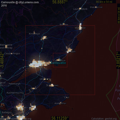
Analysis of Carnoustie night lights 2016
Square area 10x10 km:
 0%
0%90-99
0%80-89
0%70-79
0.91%60-69
0.23%50-59
0.23%40-49
0.45%30-39
0.45%20-29
1.59%10-19
0.68%0-9
95.45%Square area 50x50 km:
0.63%90-99
0.77%80-89
0.39%70-79
0.41%60-69
0.43%50-59
0.39%40-49
0.32%30-39
0.34%20-29
1.28%10-19
2.81%0-9
92.23%Clear (daylight) street map image can be seen on geolist.org.
Map coordinates:
56° 53' 19.3" North, 3° 24' 30.3" West
56° 30' 9.5" North, 2° 42' 19.1" West
56° 6' 45.3" North, 2° 0' 7.8" West
Some cities around Carnoustie sort by population:
• Dundee
17 km =10.6 mi,  257°
257°
• Arbroath
9.9 km =6.2 mi,  47°
47°
• Saint Andrews
19.1 km =11.9 mi,  197°
197°
• Forfar
19.4 km =12.1 mi,  324°
324°
• Cupar
27.8 km =17.3 mi,  222°
222°
• Monifieth
7.2 km =4.5 mi,  251°
251°
• Brechin
25.4 km =15.8 mi,  6°
6°
• Kirriemuir
26.4 km =16.4 mi, 316°
2653704 (p: 11,430)
Sources (retrieved 2019-11-25):
» Earth at Night: Flat Maps 2012, 2016