Duntocher night lights from space
Night Light of Duntocher (Scotland) from space (United Kingdom) Src. Average luminocity for 10x10km area is 54.2118% and for 50x50km: 24.2591%.
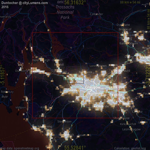
Analysis of Duntocher night lights 2016
Square area 10x10 km:
 15.79%
90-99
11.9%80-89
5.26%70-79
6.02%60-69
7.77%50-59
3.76%40-49
4.76%30-39
6.02%20-29
15.54%10-19
19.3%0-9
3.88%Square area 50x50 km:
6.99%90-99
6.15%80-89
1.84%70-79
2.28%60-69
2.48%50-59
2.17%40-49
2.38%30-39
2.74%20-29
4.43%10-19
9.97%0-9
58.58%Clear (daylight) street map image can be seen on geolist.org.
Map coordinates:
56° 18' 58.8" North, 5° 7' 6.9" West
55° 55' 27.7" North, 4° 24' 55.6" West
55° 31' 42.3" North, 3° 42' 44.4" West
Some cities around Duntocher sort by population:
• Bearsden
5.2 km =3.2 mi,  101°
101°
• Clydebank
2.6 km =1.6 mi,  166°
166°
• Renfrew
6 km =3.7 mi, 166°
• Dumbarton
9.9 km =6.2 mi,  282°
282°
• Erskine
3.4 km =2.1 mi,  219°
219°
• Milngavie
6 km =3.7 mi,  72°
72°
• Linwood
9.8 km =6.1 mi,  209°
209°
• Faifley
1.9 km =1.2 mi,  76°
76°
2650646 (p: 7,036)
Sources (retrieved 2019-11-25):
» Earth at Night: Flat Maps 2012, 2016