Inverkeithing night lights from space
Night Light of Inverkeithing (Scotland) from space (United Kingdom) Src. Average luminocity for 10x10km area is 39.1404% and for 50x50km: 22.3071%.
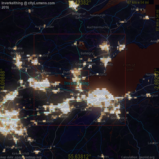
Analysis of Inverkeithing night lights 2016
Square area 10x10 km:
 4.39%
4.39%90-99
5.26%80-89
6.39%70-79
7.27%60-69
7.64%50-59
3.76%40-49
3.01%30-39
2.88%20-29
19.55%10-19
30.33%0-9
9.52%Square area 50x50 km:
4.61%90-99
5.03%80-89
1.92%70-79
1.77%60-69
2.05%50-59
1.91%40-49
2.05%30-39
2.72%20-29
9.12%10-19
15.99%0-9
52.83%Clear (daylight) street map image can be seen on geolist.org.
Map coordinates:
56° 25' 25.8" North, 4° 5' 55.2" West
56° 1' 58.7" North, 3° 23' 44" West
55° 38' 17.2" North, 2° 41' 32.7" West
Some cities around Inverkeithing sort by population:
• Dunfermline
5.8 km =3.6 mi,  317°
317°
• Rosyth
2.7 km =1.7 mi,  279°
279°
• Cowdenbeath
9.3 km =5.8 mi,  19°
19°
• Dalgety Bay
2.8 km =1.7 mi,  85°
85°
• Queensferry
4.7 km =2.9 mi,  182°
182°
• Kelty
11.2 km =7 mi,  2°
2°
• Lochgelly
11.9 km =7.4 mi,  26°
26°
• Burntisland
10.3 km =6.4 mi,  73°
73°
2646104 (p: 5,220)
Sources (retrieved 2019-11-25):
» Earth at Night: Flat Maps 2012, 2016