Dalgety Bay night lights from space
Night Light of Dalgety Bay (Scotland) from space (United Kingdom) Src. Average luminocity for 10x10km area is 29.406% and for 50x50km: 21.3494%.
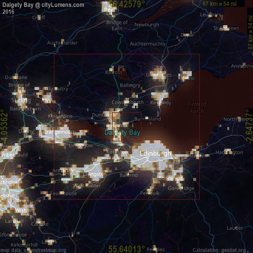
Analysis of Dalgety Bay night lights 2016
Square area 10x10 km:
 2.88%
2.88%90-99
3.26%80-89
4.39%70-79
4.26%60-69
6.52%50-59
2.88%40-49
2.88%30-39
1.38%20-29
16.42%10-19
25.94%0-9
29.2%Square area 50x50 km:
4.43%90-99
4.77%80-89
1.84%70-79
1.75%60-69
1.97%50-59
1.8%40-49
1.88%30-39
2.58%20-29
8.69%10-19
15.11%0-9
55.19%Clear (daylight) street map image can be seen on geolist.org.
Map coordinates:
56° 25' 32.8" North, 4° 3' 13" West
56° 2' 5.9" North, 3° 21' 1.8" West
55° 38' 24.5" North, 2° 38' 50.5" West
Some cities around Dalgety Bay sort by population:
• Dunfermline
7.9 km =4.9 mi,  301°
301°
• Rosyth
5.4 km =3.4 mi,  272°
272°
• Cowdenbeath
8.6 km =5.3 mi,  2°
2°
• Queensferry
5.7 km =3.5 mi,  211°
211°
• Kelty
11.2 km =7 mi,  348°
348°
• Lochgelly
10.7 km =6.6 mi,  13°
13°
• Burntisland
7.5 km =4.7 mi,  69°
69°
• Inverkeithing
2.8 km =1.7 mi, 265°
8739669 (p: 9,810)
Sources (retrieved 2019-11-25):
» Earth at Night: Flat Maps 2012, 2016